Cooper's Gravel Tour
Bay Area by Bike
If you read the first article about my proposed trip to the San Francisco Bay Area by bike, you may have sensed some hesitation, especially around sharing specifics of my route. A large part of this hesitation was because I wasn't sure (positive, really) I was going to be able to complete it. You can't publicly fail if no one knows what success is, right?
There were too many unknowns; the route was too long, and as we discussed I was pushing the limits of my experience. And although I did trim a bit out before I left, I also added some other bits, and somehow it all just worked. Yes, there were some on the fly changes, hiccups, and on day one I hit the wall harder than I ever have, but overall it was a massive success and I more or less followed the route as planned. Win!
Here's how it all went down; in an upcoming piece we'll cover all the gear specifics.
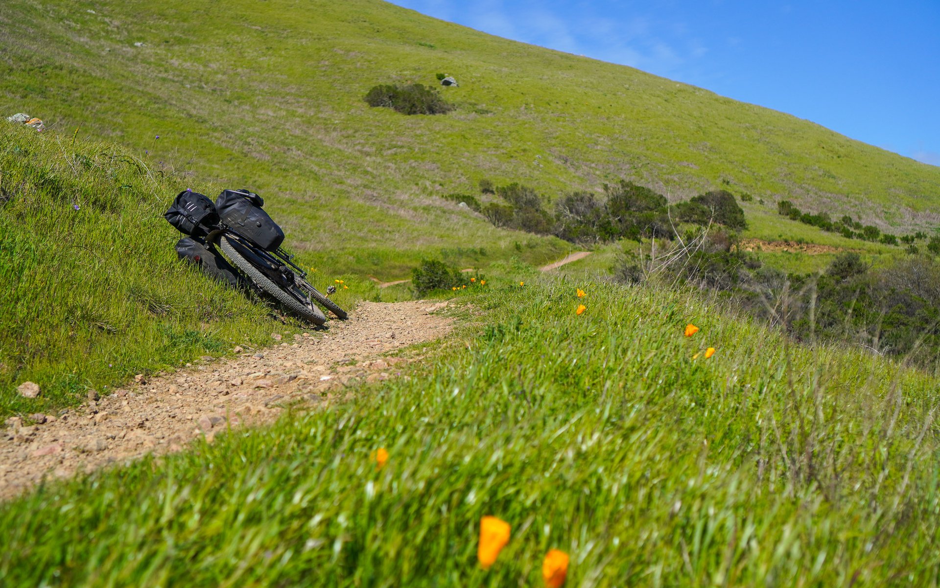
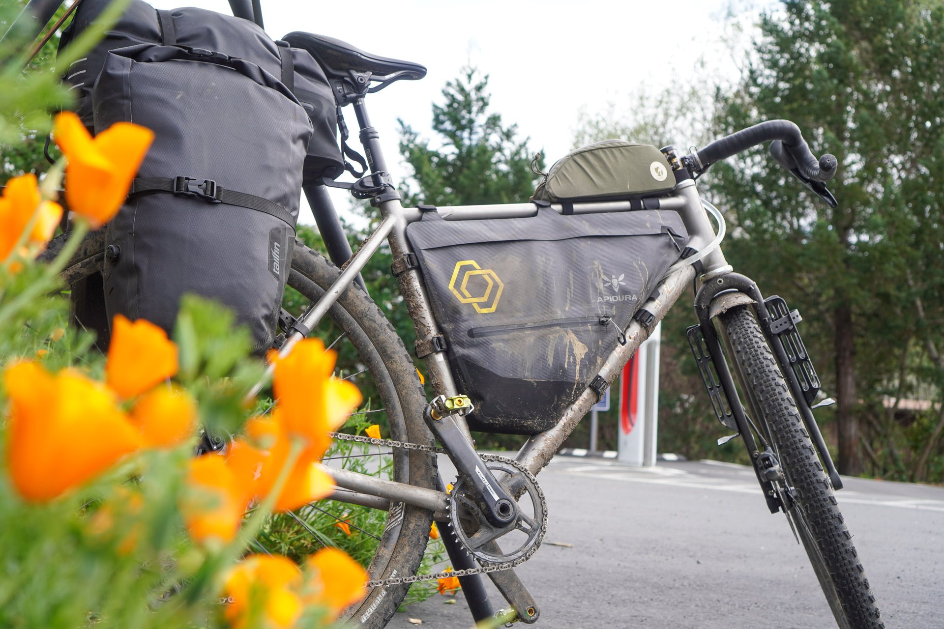
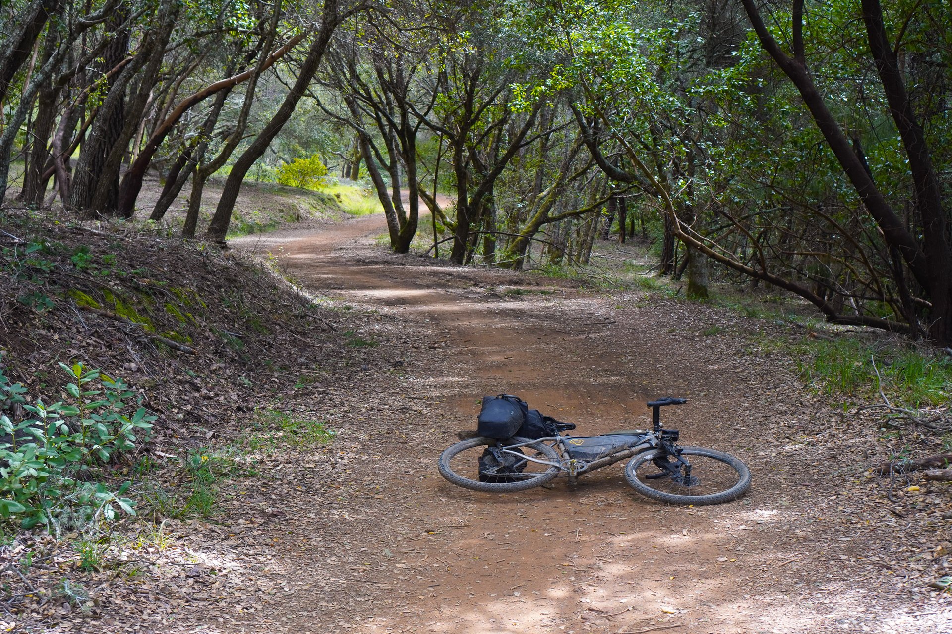
Day One. 93 km, 2,362m (Part 1, Part 2)
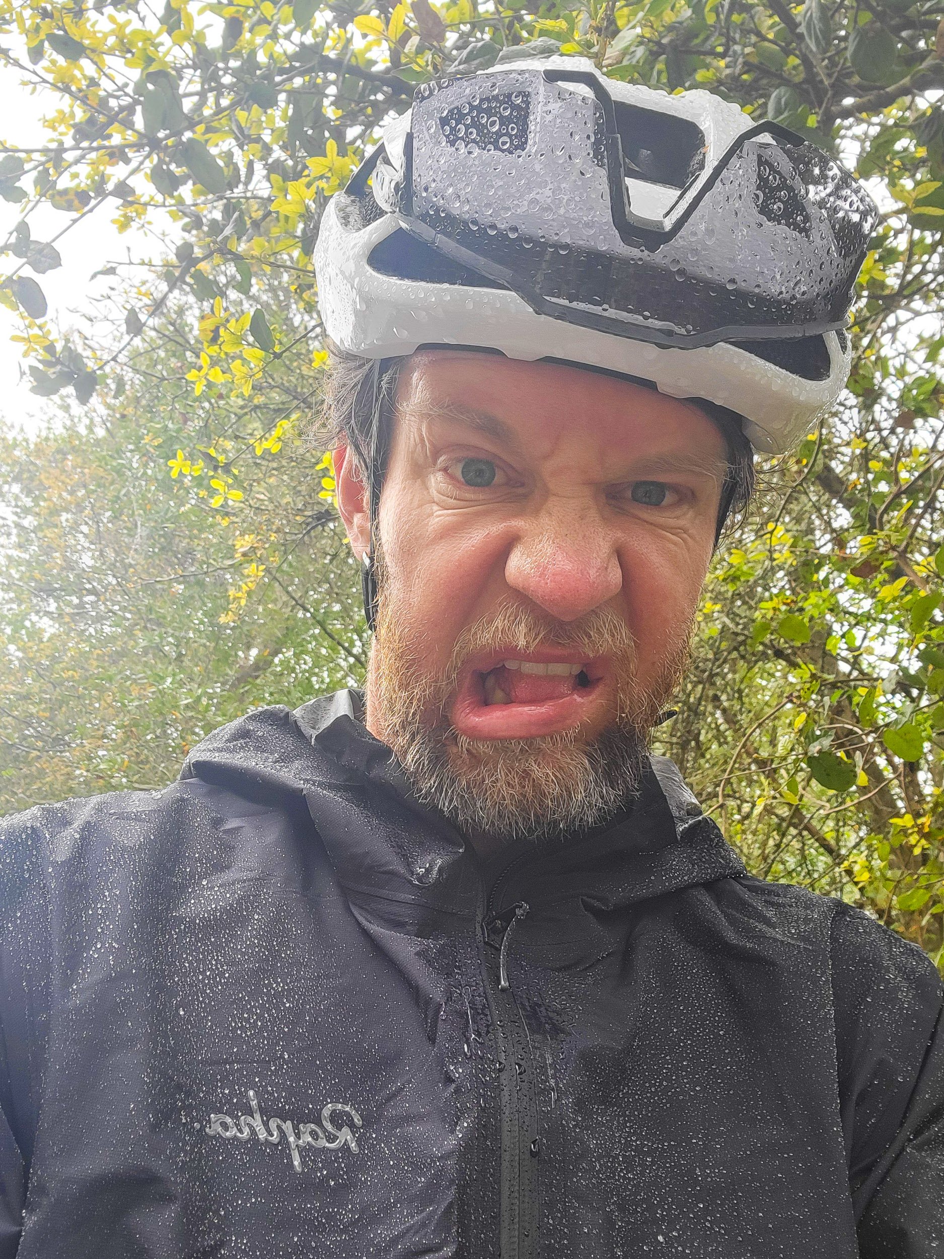
With a 4:45 am call time to get out the door, a plane ride, and twenty five hundred meters of elevation on the docket, day one was never going to be easy. But there was also plenty to look forward to, with trolleys, some snack favorites, and a big red bridge to ride across.
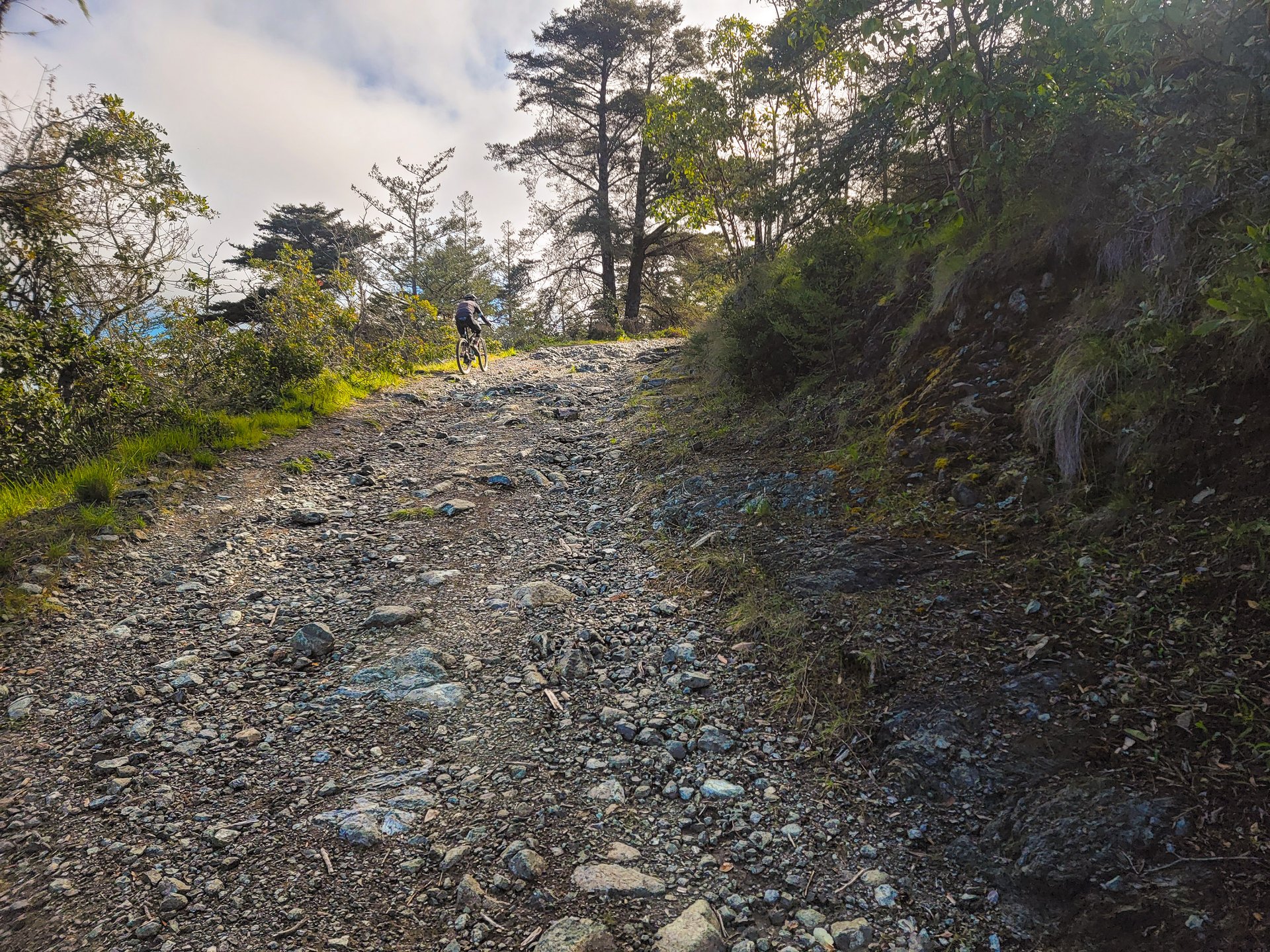
My bike build, bag drop off, and train down to the Ferry Building on Embarcadero went smoothly, albeit slowly due to some navigational errors between the airport, bag drop, and transit stop. By the time I was across the Golden Gate I was approximately 2 hours behind schedule. It should also be noted, pedaling across that bridge isn’t as romantic as it sounds - crowded two way bike traffic, classic San Francisco Bay winds, and traffic noise make for an experience I wouldn’t recommend doing just for the sake of it. However, once you’re across and into the Marin Headwinds - sorry, Headlands - you’re in gravel bike heaven.
Marin Headlands trails are truly just awesome on a gravel bike.
The descent to Muir Beach fun, and shared with a local gravel rider I'd encountered a few times throughout the afternoon.
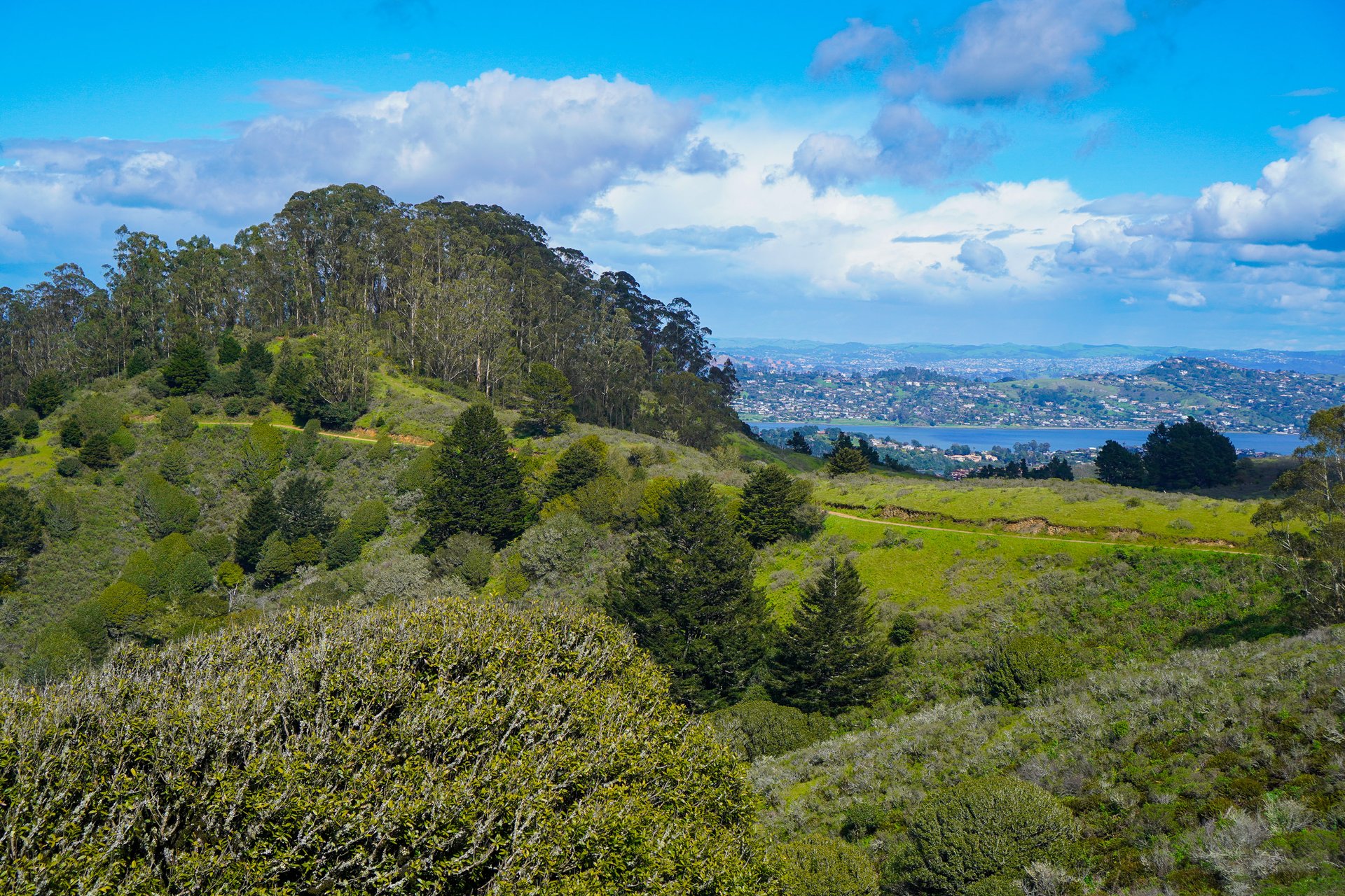
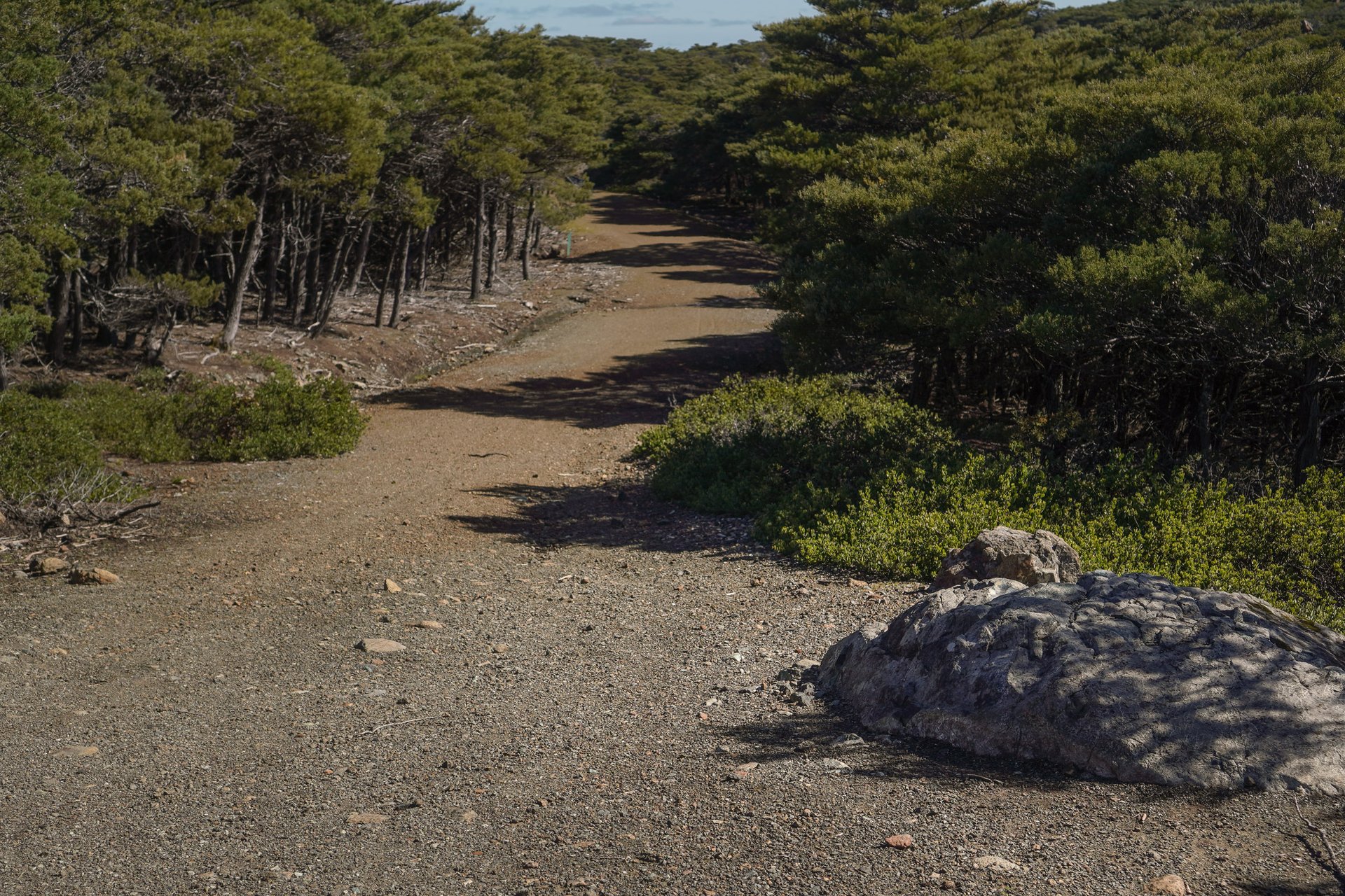
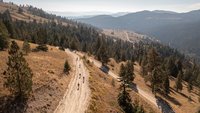
Bolinas Ridge covers several different ecological zones as you move across its length; once you exit the deep redwood trees, the northern end is used for cattle grazing, and has spectacular views.
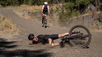
I knew going into it the day was always going to be a push, but as the day progressed I became reasonably sure I was going to make it to the campsite somewhere around dark. Deep in the redwood trees of Bolinas Ridge with around 20km to go, it became clear my time on distance was off, as my speeds were tumbling. And then it got ugly. After the worst descent of the trip I broke, heading up the final climb. In the dark, the final kilometers took me an hour, head down; my only focus, trying to keep the cranks spinning. For the icing on the cake, as I walked off the main campground trail onto the path to my site, I got hit with stinging nettles. Tent. Dinner. Sleep.
Lesson one. Pay close attention to specifics, and have everything mapped out. I lost a lot of time getting to my bag dropoff point and transit. Streamlining this would have made the whole day much easier, although it was alway going to be a stretch with half the day consumed by flying and airports.
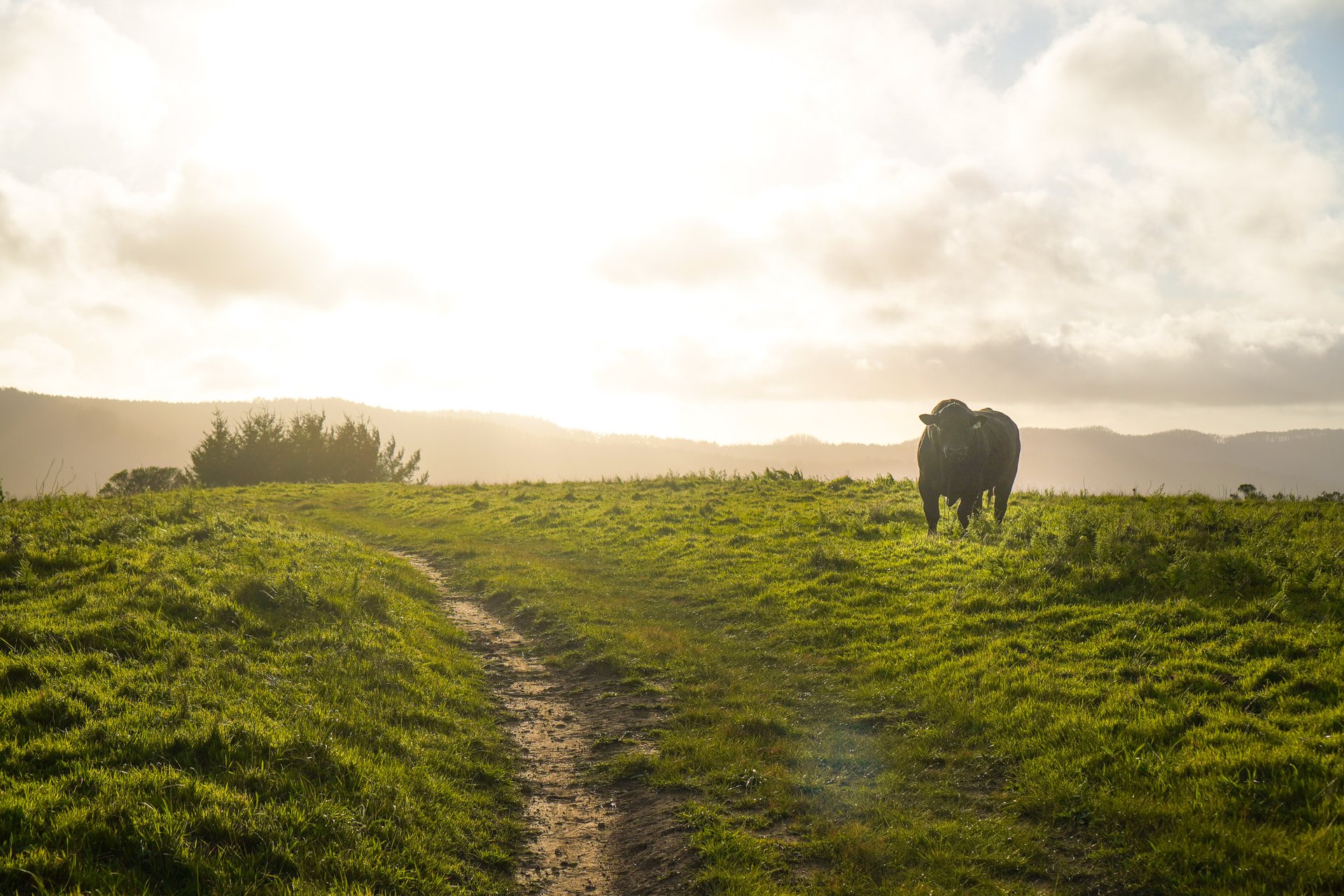
Shortly before the (awful) descent, I encountered this fellow, who was very intent on looking intimidating. I walked by, carefully.
Day Two. 76 km, 1,423m (Link)
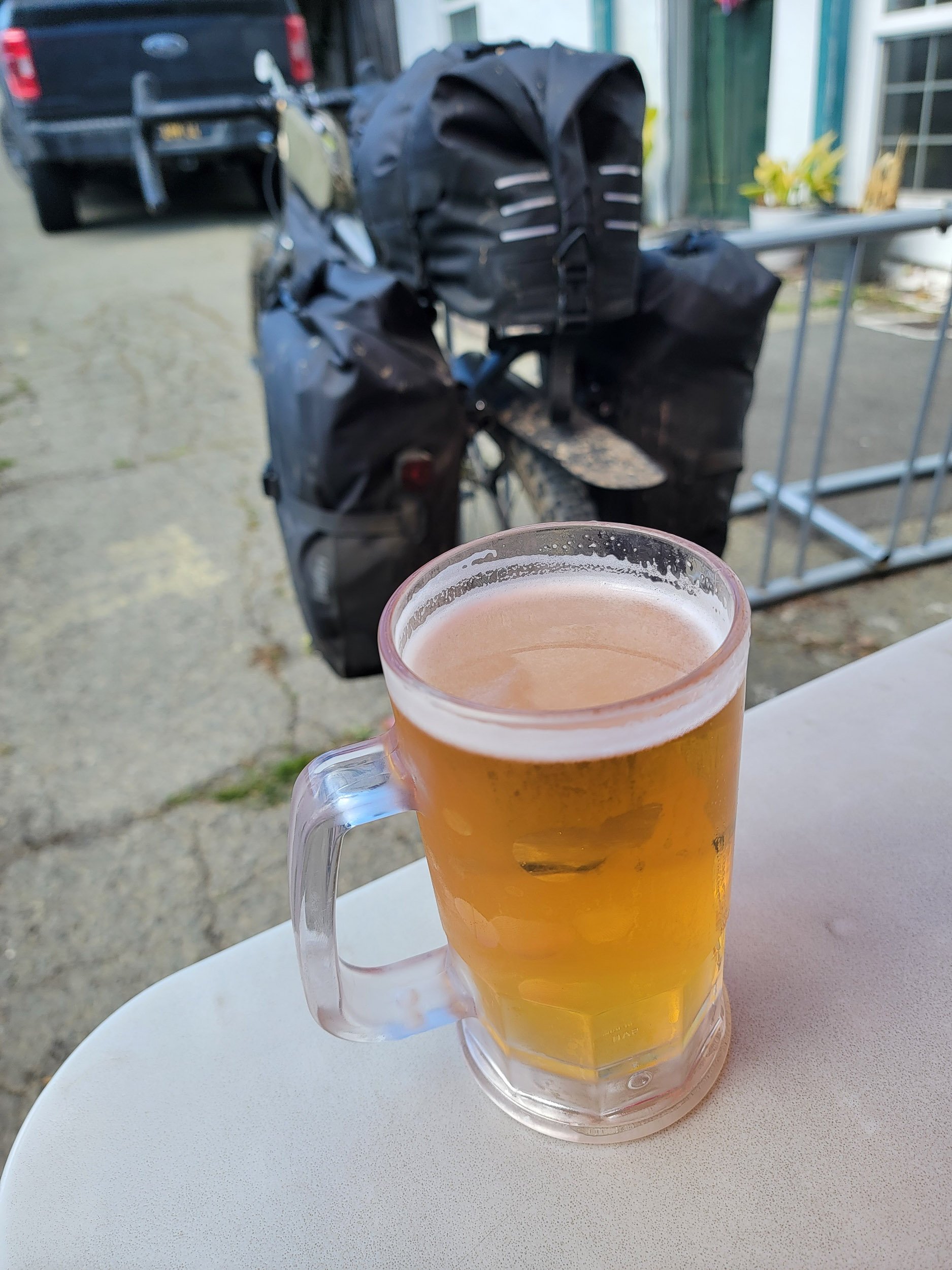
Mornings were relaxed, knowing the only thing I needed to do that day was ride my bike. Each day I was typically up around 7:30 for coffee, stroopwafels, packed and rolling around 9ish. Day two was a solid mixed surface day starting with single track, plenty of gravel and double track, all connected with some classic Bay Area road riding. It was also in an area I had a solid lay of the land in my head from previous non-bike visits. Basically, I already knew where I was getting good coffee, good snacks, good sandwiches, and good beer in and around Point Reyes Station.
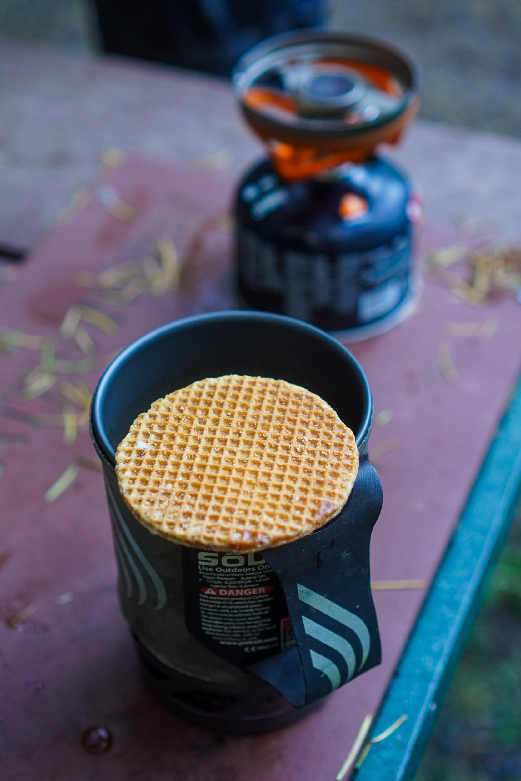
Pro-tip: while Honey Stingers are good, and easy to find at many sports and bike shops. You can save a pile of money and plastic by finding a grocery store that has stroopwaffels in bulk bags.
They're great fuel for morning or anytime, and they powered me onto the day's first singletrack.
I was comfortable on my bike, settled into the routine, and as I would learn from chatting with some folks on a sunny patio I managed to, “hit all the local high points” from a riding perspective. To cap off a day of widely varied terrain, great descents, and big trees and big views, I finished with some rail grade trails through the valley, good Indian food, and a shower.
Lesson two. Listen to the locals - I got some good beta and modified my planned afternoon route based on that same patio conversation due to recent weather.
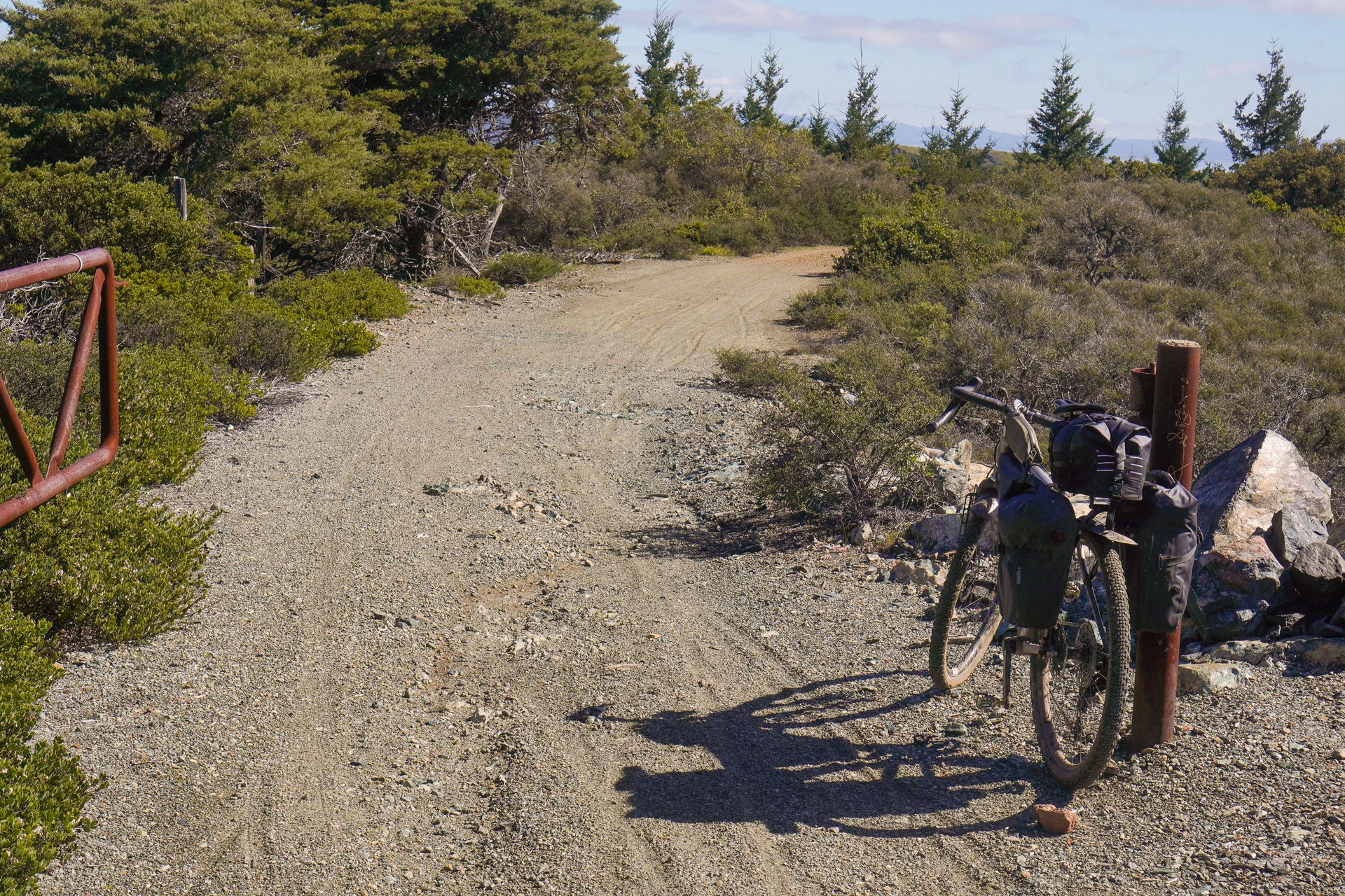
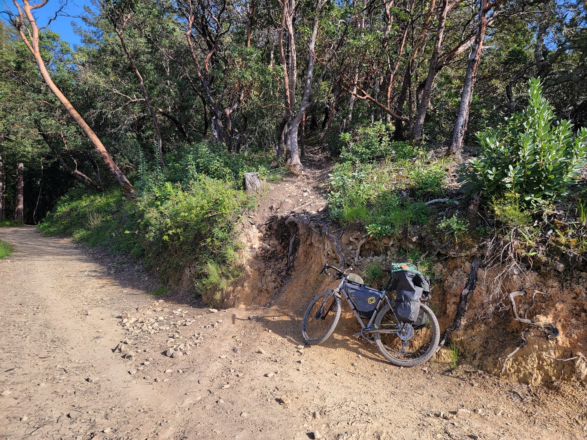
The first solid climb of the day switch-backed up onto Inverness Ridge; the mountain bike descent that the climb crisscrossed looked like good fun, although likelihood of poison oak looked nearly certain.
What's California without some poppies and a Tesla charger?
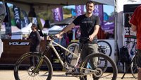
And what's Marin County without some old school custom bikes? I'd later learn this belonged to the owner of the local bike shop, Black Mt. Cycles. I'd tried to stop by the shop - I've been before and it is full of neat stuff - but learned that Monday was the owners day to ride.
Day Three. 92 km, 2,092m (Link)
If you were looking at this report for trails to go ride, day three is the day I'd repeat. The major change I would make would be to go a different day of the week so that the mountain bike Hall of Fame is open. It's also worth noting that Repack Hill is steep, rough, and nearly unimaginably difficult for me to fathom riding on some awful klunker with a coaster brake. I'm glad I did it. It was very neat to ride, but as my riding guide for the morning described, Repack is a bit of a “waste of good vertical” compared to some of the other trails in the Watershed.
Two of these, two brats, and it was hard to motivate to get back on my bike. If you're eating inside Gestalt Haus, you can take your bike inside and hang it on the wall for safekeeping.
I did not try the brownies. I'm still not sure if they have pot or not, but I can make an educated guess.
The hardest part of day three was leaving the patio of the Gestalt Haus in Fairfax and not just sitting and seeing how many more beers and sausages I could consume before collapsing. But I slowly climbed back aboard, and it was absolutely the right call as the afternoon trails were picture perfect. The climbs were a bit grindy at times which was a theme throughout the trip, but long flowing singletrack descents made the juice worth the squeeze.
Lesson three. The Marin Watershed should still be a major destination for mountain biking, however there’s zero singletrack that’s legal within its boundaries. The Marin County Bicycle Coalition is working hard to change that, and needs your support.
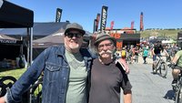
My accomplice for the morning was blessed with absurd fitness and a bike that didn't weigh as much as a horse. The climbs may have been steep, but at least they were chunky, too. (huge thanks to Galen for reaching out after reading my first piece, providing HEAPS of beta, and taking a day off work to show me around!)
There it is. The Repack Hill start rock. To paraphrase The Godfather, "Mountain biking may have been born in Marin County, but it came of age on the North Shore." While Repack isn't a spectacular descent, I'm happy to have a check mark next to it.
Just in case you're a "the race starts at the gate not the rock!" type, I've got you covered. My bike probably weighs about as much as those early klunkers.
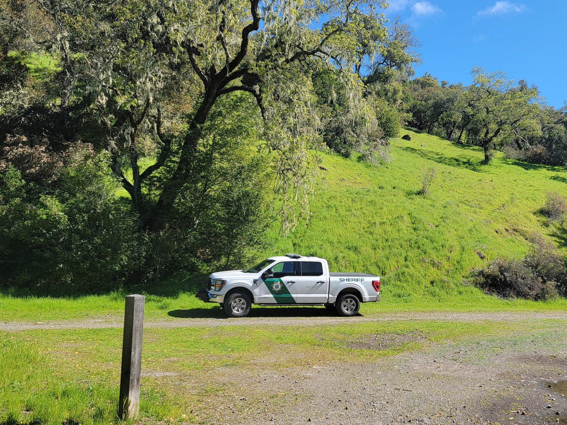
He wasn't waiting for us, but my host told me this is a common sight, and the officer was likely up the hill a little ways looking to issue citations to mountain bikers on some nearby singletrack.
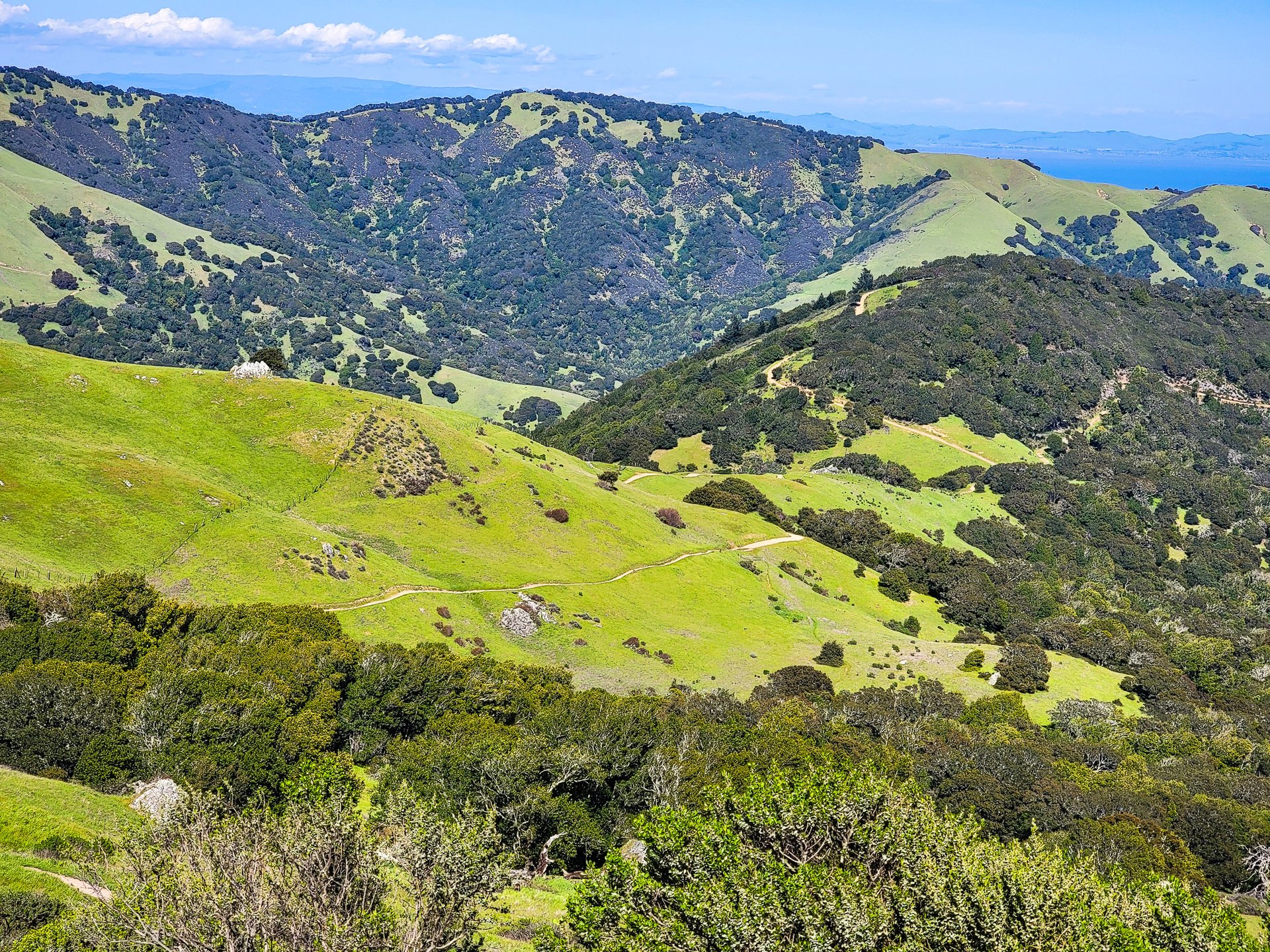
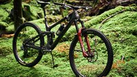
Mountainbike Police aside, the Marin Watershed has some amazing gravel riding.

My guide mentioned a loop around the lakes/reservoirs that could be added to the middle of my day before lunch, and it was a 10/10 suggestion.
Day Four. 67 km, 1,318m (Link)
On paper, it was going to be a relatively easy day across the San Rafael bridge, through Richmond, and through the Berkeley Hill; in practice it was a bit harder. Trying to beat the incoming rain across the nearly 9 km long bridge, some more needless time lost due to planning that wasn’t specific enough (I’ll get supplies and lunch in Richmond!), a reroute due to landslide, and the aforementioned weather slowed me down through an afternoon of very punchy climbs. Chalk it up to Sea to Sky ego and that lack of attention to fine route detail, but I wasn’t expecting the number of climbs in excess of 12 or 15% that I encountered throughout the trip.
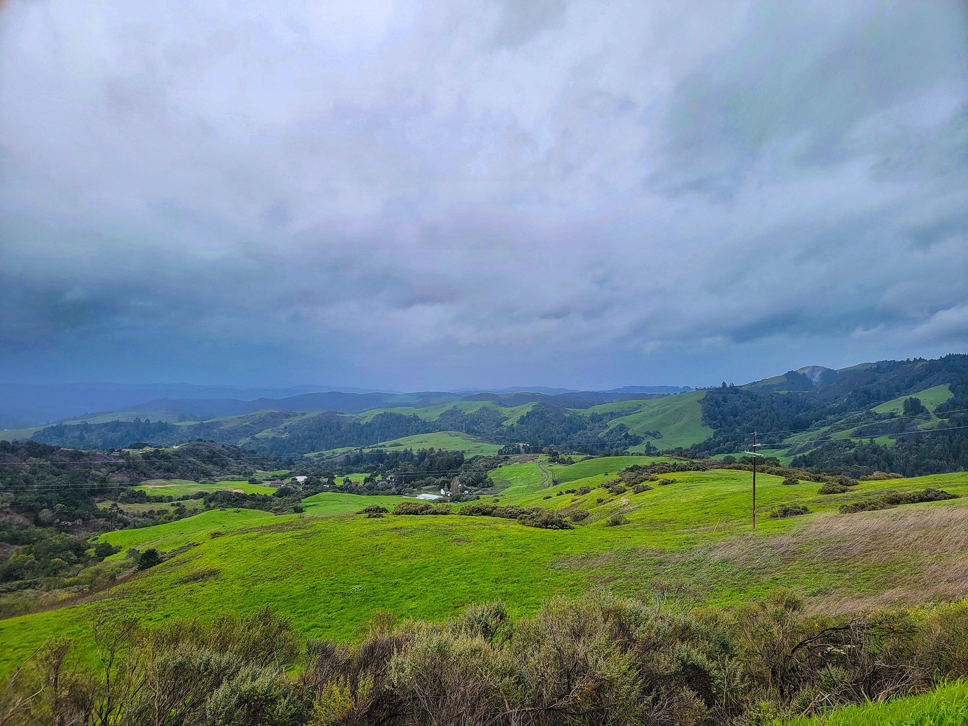
Looking back, this shouldn’t have been a surprise; I was often on forestry roads built in a somewhat similar climate to here in Southwestern BC… of course they’re similar grades. Day four was the only day I gave up and just hopped off to push up several significant climbs; this was rewarded with some spectacular views, and a surprised appreciation for how close I was to so many people, and yet I encountered very few, and often felt deep in the woods. It was also the first day I was glad I packed Goretex.
Lesson four. You’re always going to get to camp later than you expect, and closer to dark than you think. Get your tent set up first, you’ll thank yourself later.
Despite being outlawed seemingly everywhere... evidence of mountain bikers was also inescapable.
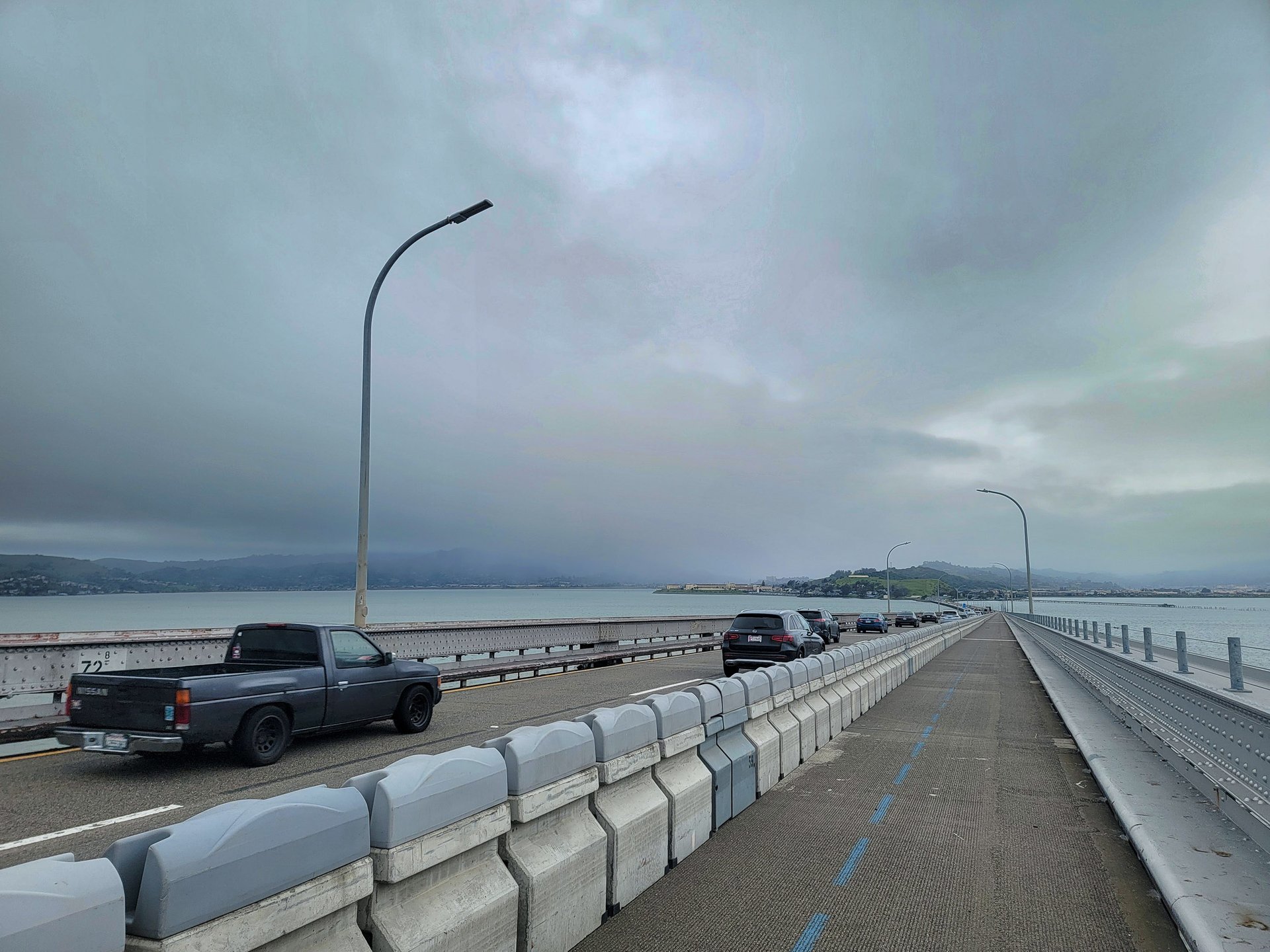
I beat the incoming storm across the bridge, however it would catch me later in the day.
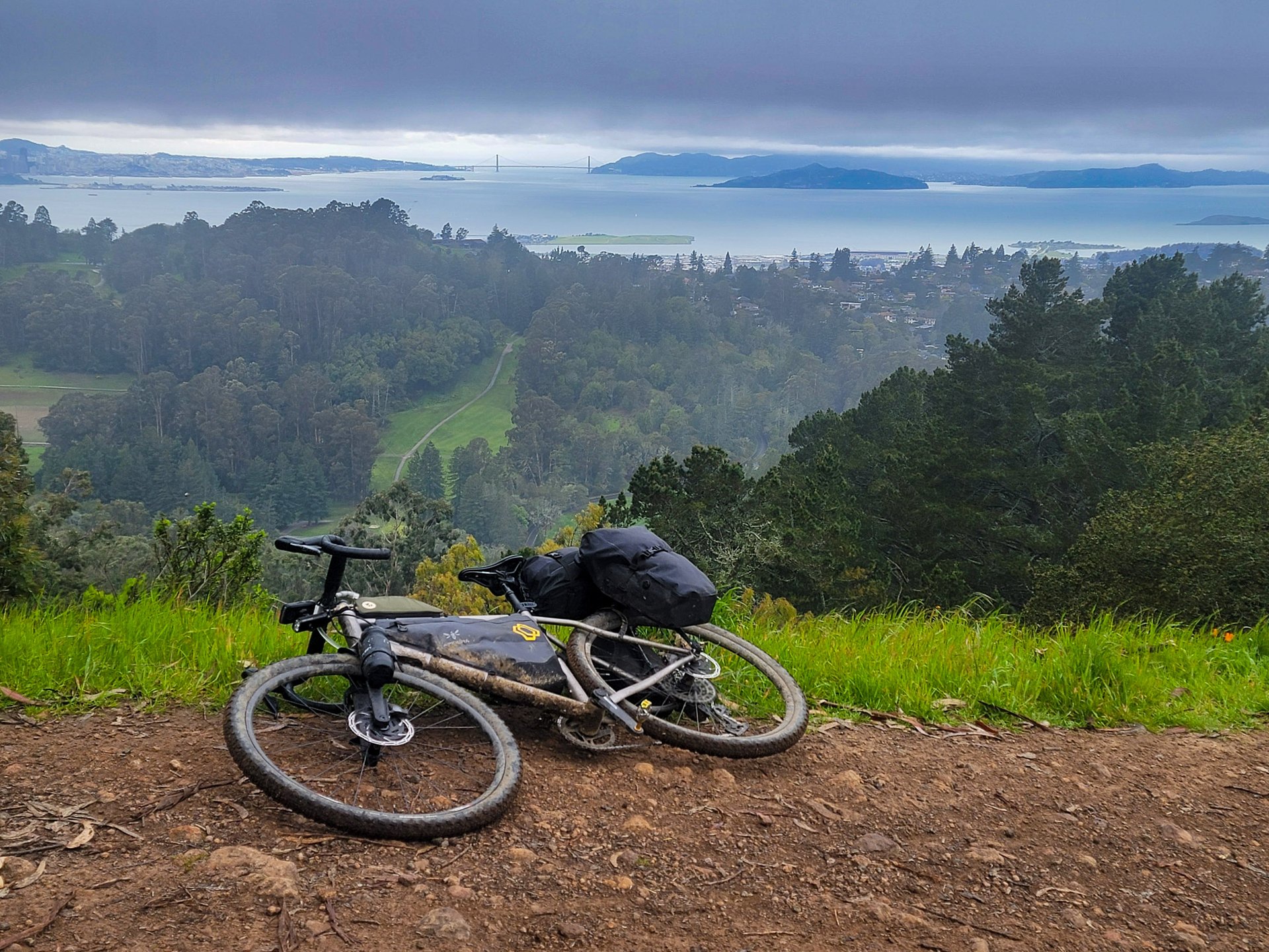
The Golden Gate and Transamerica aren't visible from everywhere in the Bay Area, but once you get up high you often catch a glimpse.
Wet. Windy. Thank goodness for Goretex.
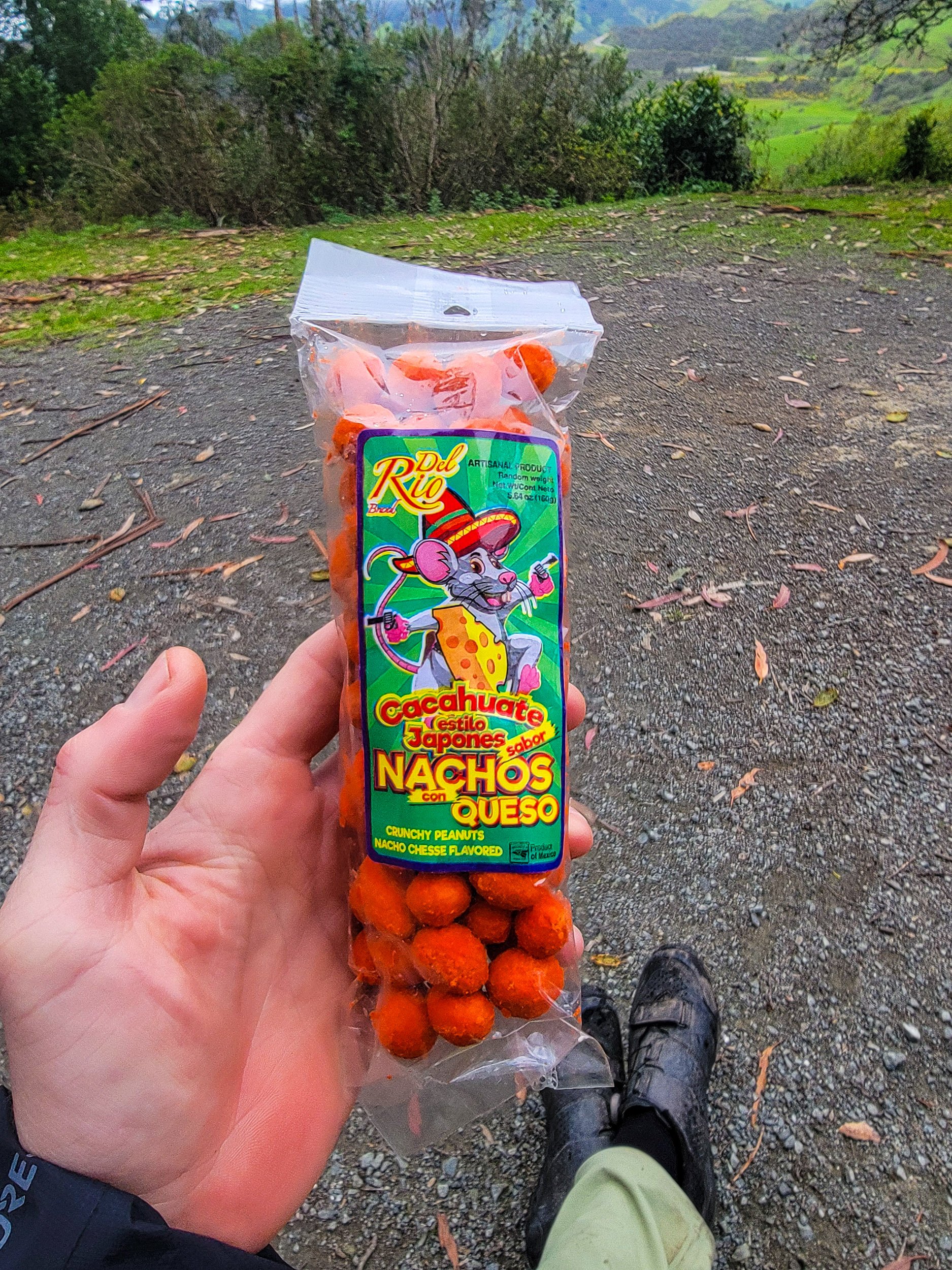
Always on the hunt for new snacks, a roadside stand delivered with these beauties. As my partner said when I sent her a photo "Everyone knows neon orange is the best flavor of cheese".
Day Five. 123 km, 1,611m (Link)
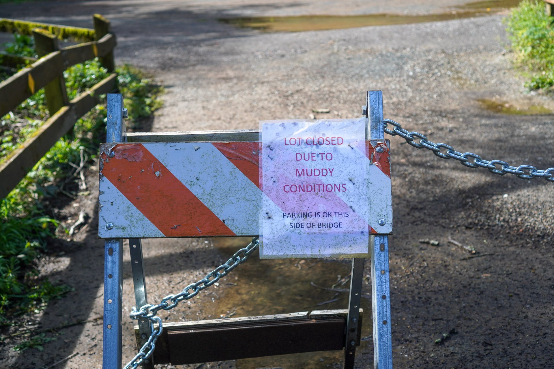
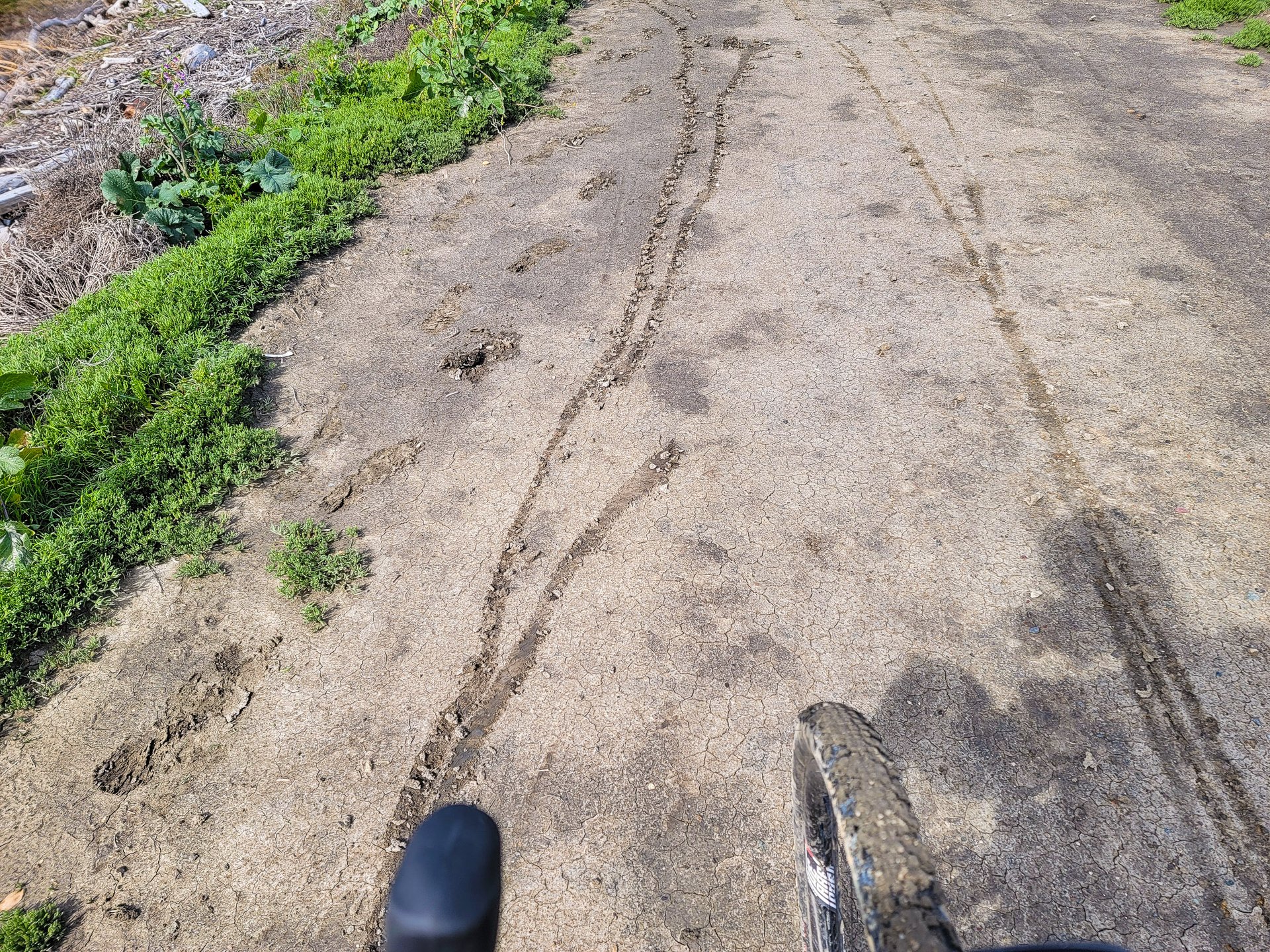
The day I’d been most worried about completing started off slow. Everything was wet, and I got out of camp like a herd of turtles. It was the longest day - by distance - by a wide margin, necessitated by a large gap in known areas to camp. I had pre-planned a few different bailout options to get out of the hills and down along the water where it was flat; I ended up doing this partially to save vert, but largely because the trails were a slippery, sticky mess. I’m blessed to live in an area with very limited clay, and where we can ride basically year round. You need to be smart with your wet weather trails, but as a general rule we lack that wheel-stopping, drivetrain ruining shit that accumulates until it's several inches tall on the bottom of your shoes.
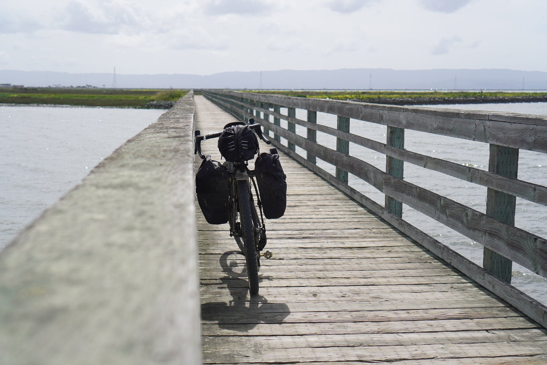
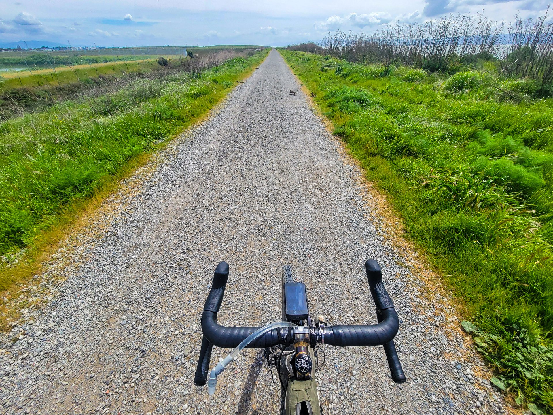
So down I bailed, through San Leandro, and along some wonderful dike trails by the bay with shorebirds, headwinds, tailwinds, and no hills. I put my head down, pushed hard, and made up some time lost earlier in the day on the way to Dumbarton Bridge. Next stop, Mountain View, where I picked up some supplies (Breaking news: a market catering to the tech-wealth of Mountain View has more options than Richmond. If anyone knows where to get Walking Tamales in Canada/Metro Vancouver, I’m addicted.)
The day’s riding ended with what would be an absolutely stunning road bike descent, which I struggled to acknowledge as I was going up it on a fully loaded bike at the end of a big day. The temperature dropped dramatically as I arrived in camp. I struggled to get changed into warm gear, jumped into my bag with a puffy coat on, and wound up making Extra Spicy dinner in the vestibule before conking out.
Lesson five. Knowing where and how you can bail - or having route variations and options pre-planned can save your bacon; spend lots of time looking at maps ahead of time if you don’t know the area well. This will pay dividends if (when) you need to think on your feet and come up with a new route for the day.
Got packed up and out of here with approximately zero urgency, thinking I'd probably resort to Cal-Train to get part of the days mileage done.
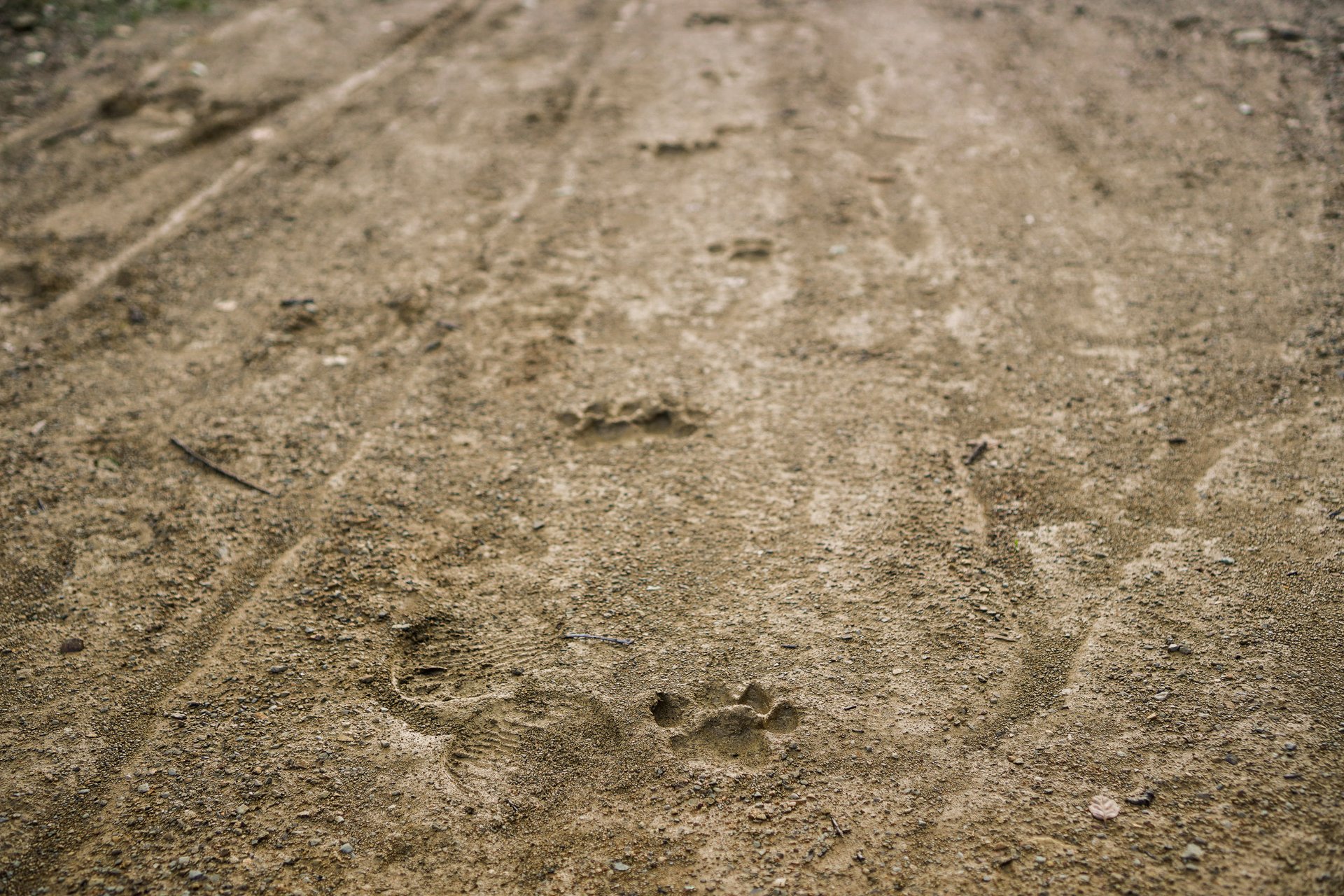
The slippery, stick mud made it difficult to stay upright on the descents, and difficult to more forward on the climbs. The cougar that had come through earlier that morning didn't show any evidence of having had similar difficulties.
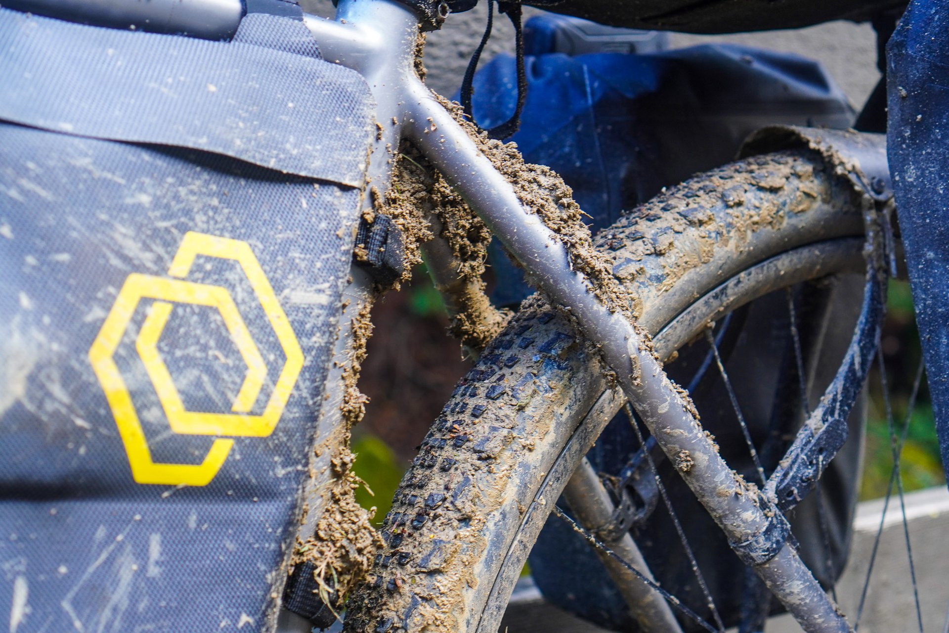
Fairly regularly I had to stop and clear some of the mud out.
This was where I finally said f*** it, and went with Plan B.
Ah, that's more like it.
A zone to get your head down and get to work - average speeds through this part of the day were high.
However, the poor soul who had been there a few hours earlier didn't have the same luck. They walked for miles - had I hit this kind of mud though the flats, there's no way I would have made it to camp.
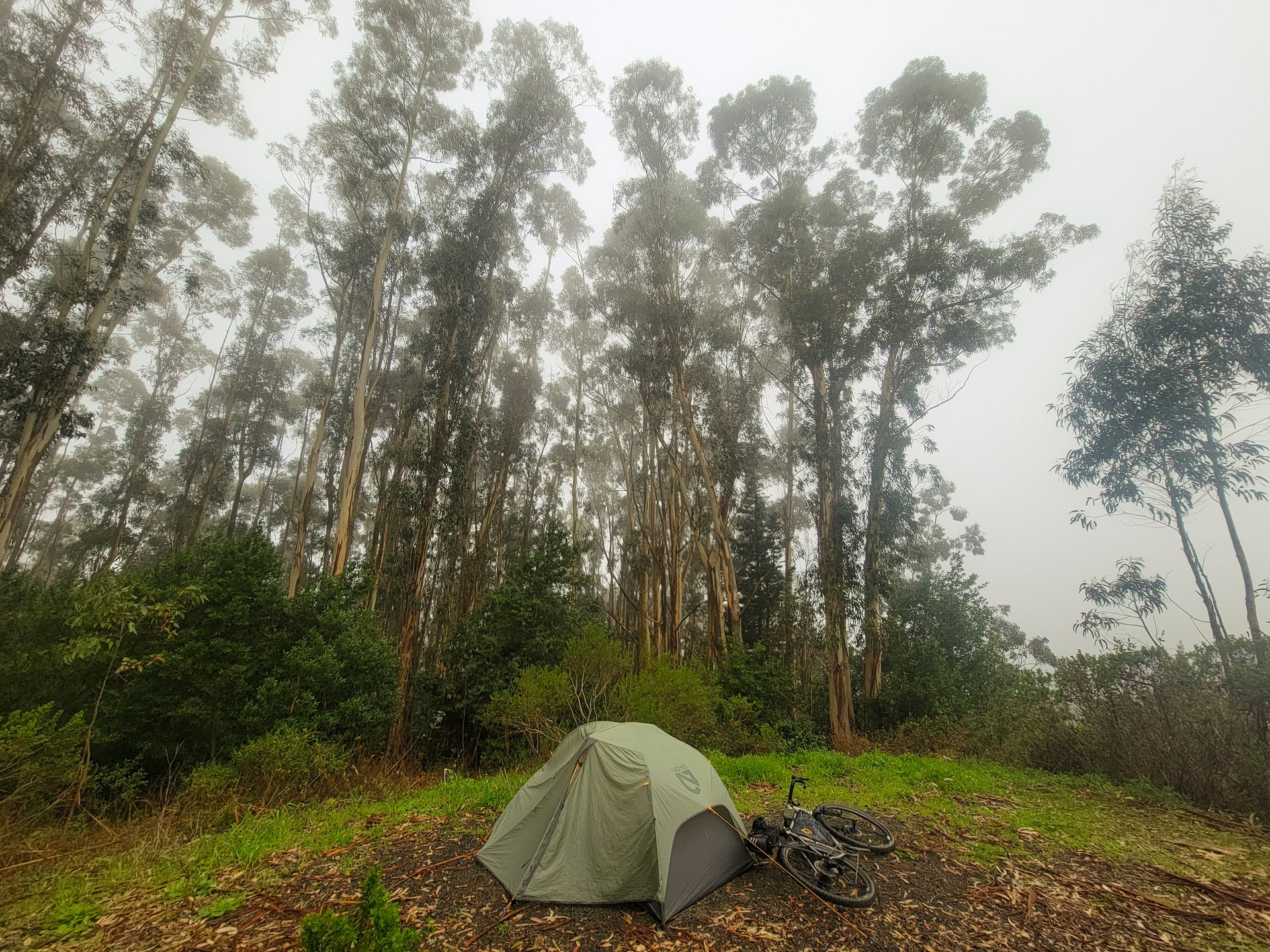
Day Six. 64 km, 730m (Link)
Cold. So cold. And wind. So much wind. After a long night wearing everything I had, I packed up my bike in the outhouse where it was relatively warm, dry, and wind free. The rain meant trails were off the menu, and I (mostly) enjoyed a day of cruising Skyline Drive in light rain. As you’d expect flying United, I started getting notifications fairly early in the day that my flight was delayed; given the day’s light climbing load and low distance requirements, this meant I was able to take my time, having a nice brunch at Alice’s Restaurant* and then enjoying familiar-feeling big trees and fog. One major upside to the weather was the wet roads discouraged most of the Californians Behaving Badly in Sportscars, and I was able to cruise without erratic BMW’s driving too fast at regular intervals.
By the time I hit the day’s descent on Highway 35 down towards the airport, it was… wet. The kind of wet where everything soaks through instantly. But yet, it was also that classic canyon-carving downhill that makes road biking in California famous; I wasn’t going to waste it. I went for it; 60km/h, on slippery roads, with a fully loaded bike on knobby tires, just pedaling with everything to keep warm and laughing at the ridiculousness of it all, and wondering what the surrounding cars thought. At the bottom, as if on queue, the rain lifted for most of the ride back to my bag**.
*I was disappointed to learn the restaurant is named after the song, not the other way around…
**It would absolutely POUR again on my ride from retrieving my bag to the airport.
Lesson six. Get moving; the day will improve once you get out of camp. Even if its still cold and wet, you’re moving.
Lesson six point five. United Airlines is terrible, always.
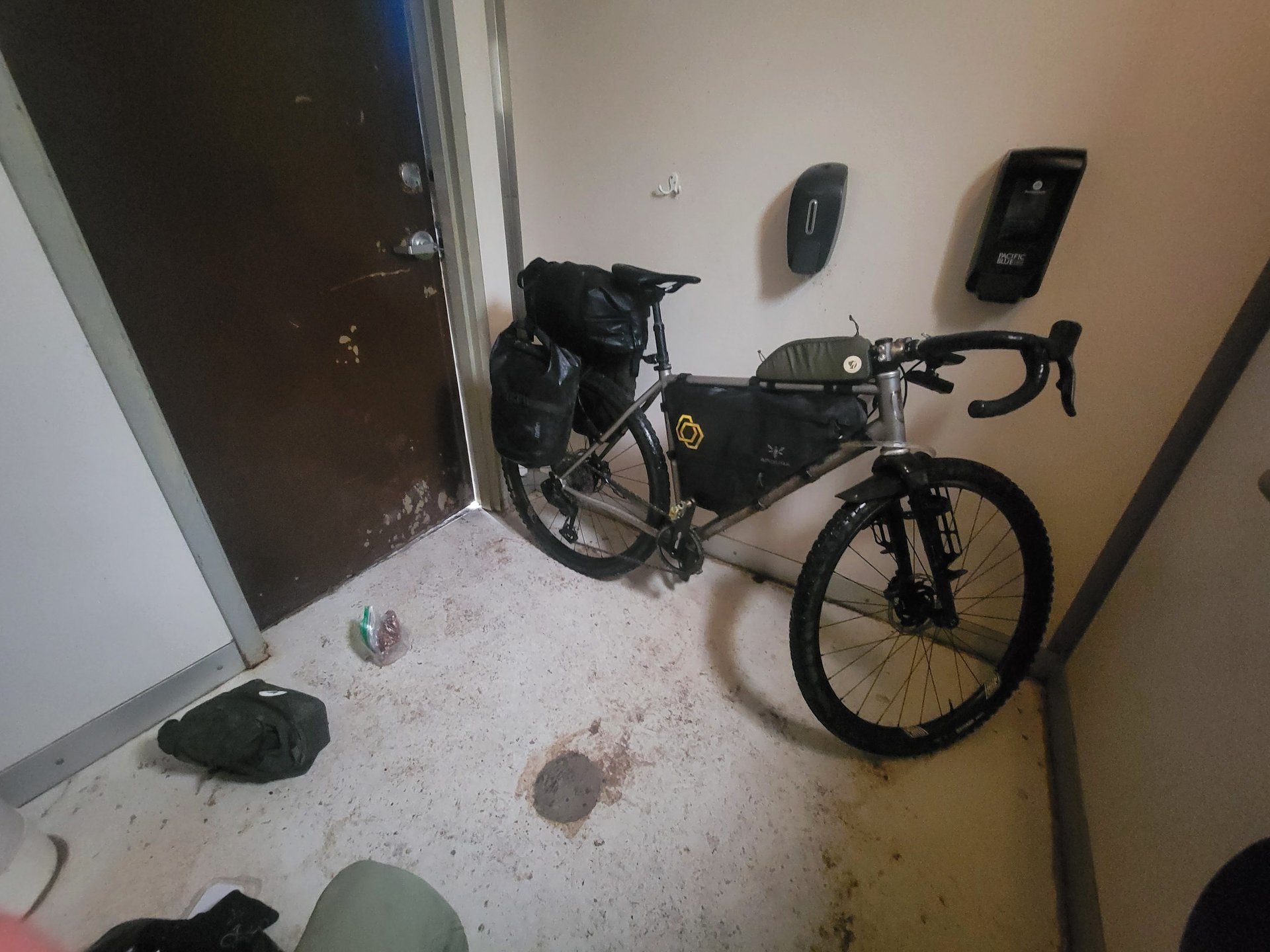
I was the only one in the campground, so used the one large outhouse to get everything packed up.
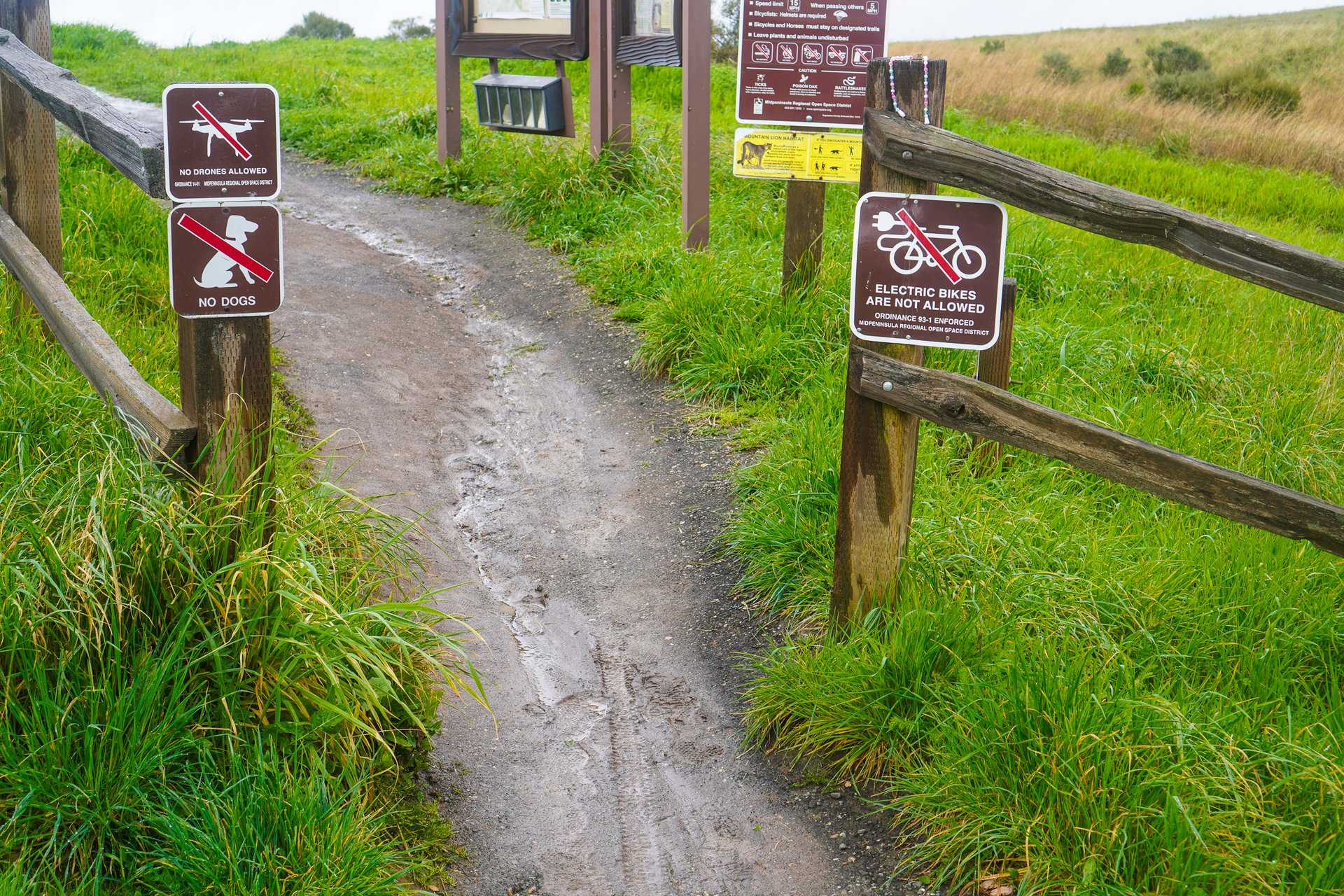
The trails were effectively unrideable. Ebike signage was prevalent throughout the SF Penninsula. I encountered many ebikes in the southern portion of the Headlands.
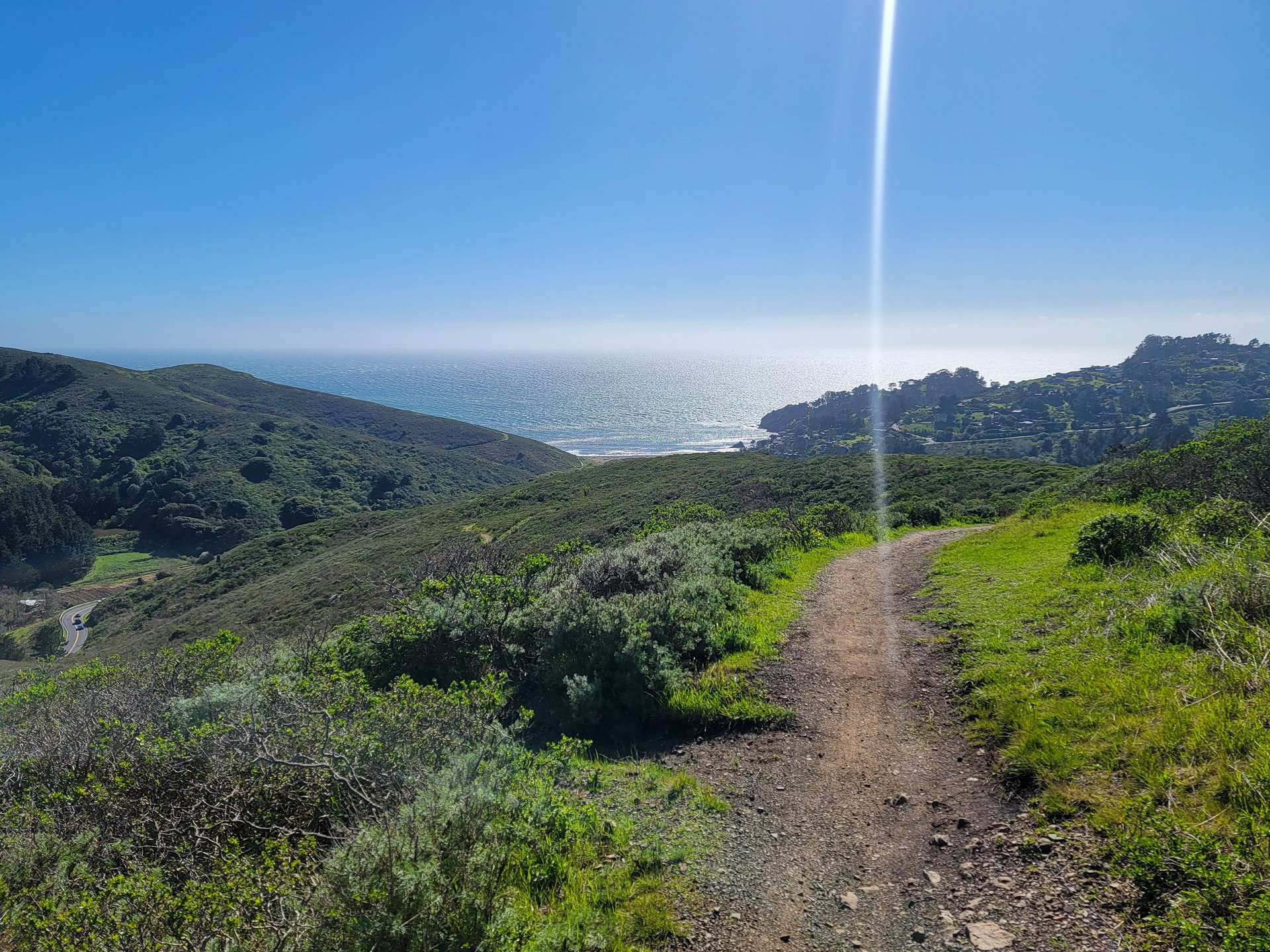
Somewhere down there is Halfmoon Bay and Mavericks.
And that was it. It worked. I don’t think anyone in the airport was impressed with my soaked gear strewn about in a quiet corner as I packed everything down, but they left me alone. After I got changed, checked my bags, I had two dinners while waiting for the plane to arrive, and we were done, and back to reality the next day.
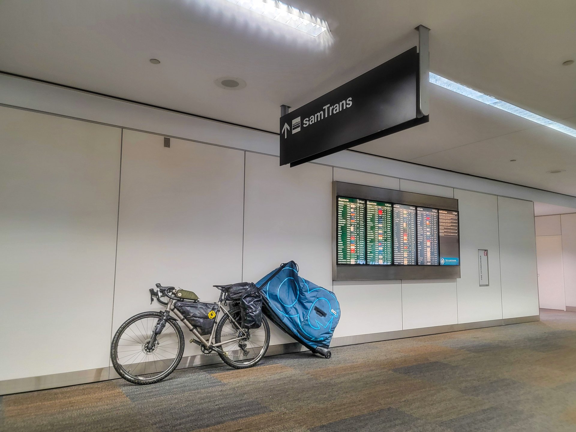
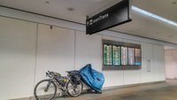
Time to pack up, clean up, and wait for a plane! In another "learn as you go", about halfway through the trip I brainstormed towing my bike bag and miraculously it worked!
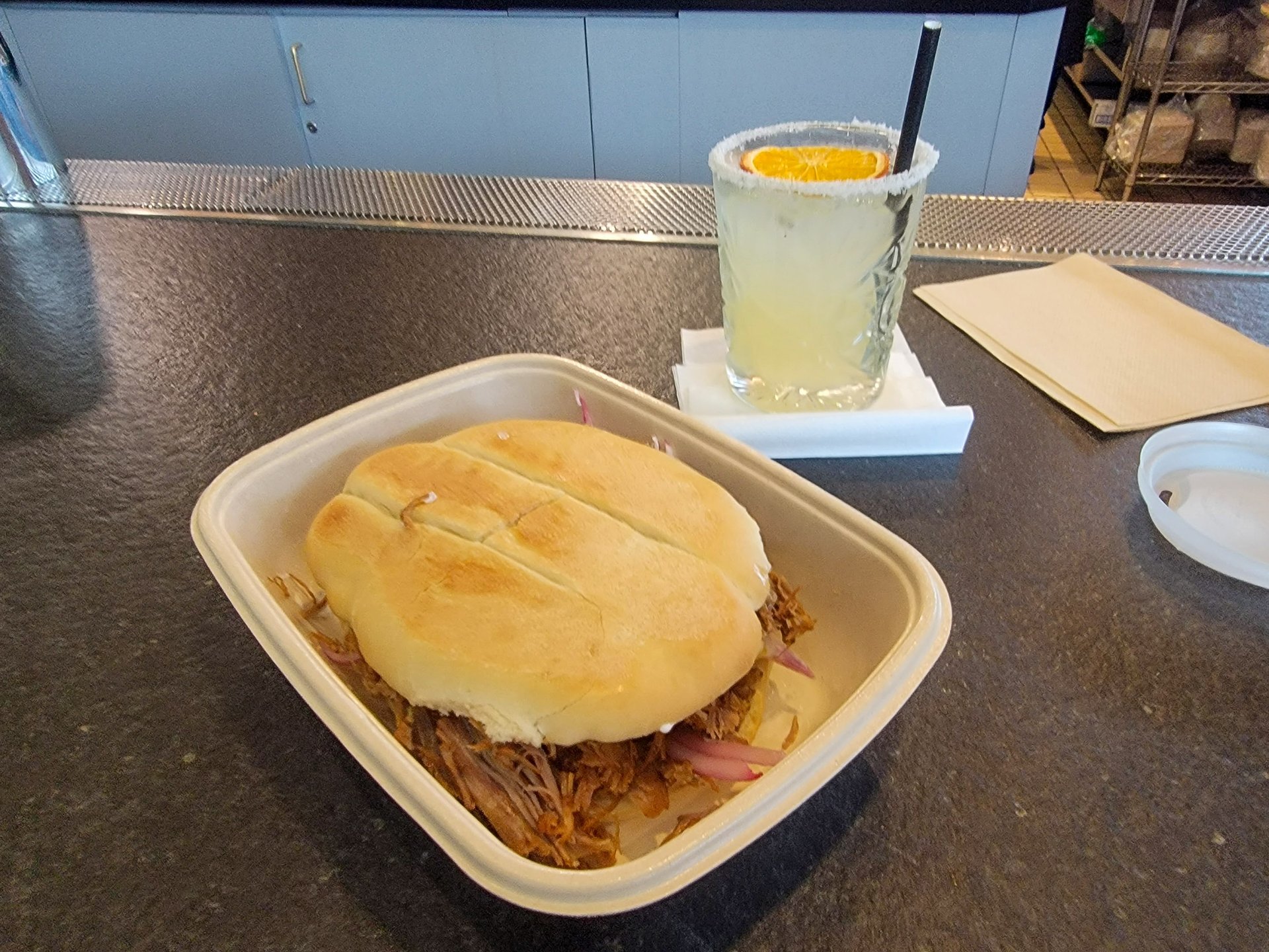
Late lunch, and a margarita. I would later eat two dinners as I waited for my flight.
This isn’t meant to be a story about how you should go find all the long days and steep hills and do nothing but ride for a week. Hopefully, it's some inspiration to just get out and do something a bit unusual and outside your normal rides. I’m the “Local Legend” on a few segments around where I live and I’m realizing those aren’t badges of honor, they’re an indicator you’re a creature of habit. You can go somewhere right in the backyard of nearly nine MILLION people, and have a grand adventure if you want. There’s a thousand variations on this trip in the Bay Area alone - whether you want to go for 10 days or an overnight the option is there.
But, if all you’re waiting on is “what gear do I take”, I’d suggest starting to book your tickets and plan your days, because we’ll talk about all that shortly.
Just one example of an amazing descent on 680, a highlight on day three I'd definitely recommend folks ride, however I'm not sure you should do the climb with a belly full of beer and sausages.

Comments
Fat_Tony_NJ
3 weeks, 2 days ago
Great read, and phenomenal pictures. Congratulations on the epic ride!
Reply
Lu Kz
3 weeks, 2 days ago
Yeah, this was a great way to start my morning, enjoying the words and pictures over coffee. Bonus was the side of beta!
Reply
Cooper Quinn
3 weeks, 2 days ago
Thanks so much!
I have a deep appreciation for the folks that manage to capture incredible riding photos, especially on solo trips. The amount of time and effort to setup and reride things and whatnot is impressive.
...you lot just get pictures of my bike in the middle of the trail.
Reply
Lu Kz
3 weeks, 2 days ago
So I've seen every episode of Survivorman over the years and I remember every once in a while he'd leave in shots that show the effort he goes through to self film. He'd show himself hiking up a hill to set up a camera for a distance hike-across-landscape shot, then he'd hike across the landscape, then you'd see him walk back. You wouldn't see him then go back to where he was. Yeesh.
Reply
dolface
3 weeks, 2 days ago
Nice write-up and wonderful pictures! Thanks for letting me tag along, that was really fun!
Reply
Cooper Quinn
3 weeks, 2 days ago
Wouldn't have been as successful or as much fun without you!
Reply
shapethings
3 weeks, 2 days ago
Love to see my backyard through the eyes of others. Been a pretty bad year for weather. Our soil just turns to goo. Thankfully, I think we’re finally closing out the rainy season (knocking on wood). Kudos to you for attacking some of those climbs fully loaded.
Reply
Cooper Quinn
3 weeks, 2 days ago
Some of your climbs are lovely! Many of them are awful!
Reply
Bro-Tato
3 weeks, 2 days ago
Great read and great photos. And as a disgruntled Marin resident, thank you this - “evidence of mountain bikers was also inescapable.” That area of China Camp is known locally as the “backside” or “Darkside” - it’s full of extremely exposed, ridge-hugging, narrow XC trails and very steep old school rutted jank that combines the thrills of little to no maintenance, sticky clay in the winter, and clouds of dust in the summer. All of it exists in a weird legal gray area - technically none of it is legal, but most of the landowners or land managers don’t enforce any rules (with some notable exceptions).
As to the route, some notes for next time:
- re day 1, you somehow chose the absolute worst way to descend to the west off Bo Ridge. Nobody goes that way. I guess you have learned this the hard way. The right way would have been to turn left slightly sooner and go down Randall, which gets (a little) more maintenance and at least attempts to stay under 12% grade. From the Randall trailhead it’s a relatively short pedal up highway 1 to Five Brooks.
- re day 2, mostly looking good, but once again you’re descending off Bo Ridge in the worst possible way via the very aptly named Shafter Grade, arguably the worst fire road in the entire watershed. Instead the way to go would have been either to pedal up Sir Francis Drake from Olema to the Cross Marin Trail entrance, or take Jewell from Bo Ridge also to the CMT. From there, the key move is to detour back onto Drake right before the campground, head up Devils Gulch Rd, and then climb Bills Trail, a 3.6 mile purpose built (legal!) singletrack that climbs through a gorgeous West Marin Forest environment and puts you at the top of Barnabe Peak (1500 ft) with spectacular views of Point Reyes. Then you can drop back down the trail or the (steep af) fire road to get back the campground in Samuel P Taylor State Park.
Reply
Cooper Quinn
3 weeks, 2 days ago
Yeah, I took some weird XC-ish trail up to that point on the China Camp ridge, before punching up the fire road. The trails I saw looked fun! Side anecdote - I'd run into a dog walker at the top of that absurdly steep road climb where I punched onto dirt, who said the trail should be fine for my setup and... well, it was, but I sure wouldn't recommend most people take a fully loaded gravel bike in there!
Having not done the other, earlier ways off Bo Ridge... I'd still agree. That was by far the worst way off, and my least favorite part of the whole trip. I'd just picked it because it spat me out right where I wanted to be at Five Brooks, and maximized my time on the ridge. Lesson learned.
I enjoyed Shafter! I didn't quite realize how much of Bo Ridge I was going to repeat, but the descent was fun and had been somewhat recently graded. I'd originally planned on taking Jewell, but that was one of the things I'd discussed with some locals while sipping that Pliny, and maybe it wasn't in great shape at the time? I also thought about heading up Bill's - in hindsight I might do this instead of the north end of Bo Ridge again.
Reply
Bro-Tato
3 weeks, 2 days ago
Re Shafter - you're the first person who I have ever heard say that they enjoyed Shafter! Then again, it's possible that it's had some maintenance since the last time I rode it, which included cavernous ruts through -18% off-camber turns and a huge fallen redwood that resulted in mandatory hike-a-bike. Also, most people complaining about Shafter are idiots like me who decided to climb it... ugh.
Re: Jewell - it would not surprise me at all to hear that it's wrecked right now. GGNRA, the land manager for that trail and for almost all of Bo Ridge, takes a rather... laissez faire approach to maintenance. There's a somewhat infamous rutted section of Bo Ridge (that I think you may have ridden through on day 2) known by locals as the "cracks of doom." On the right wet year, you can actually put your whole bicycle plus yourself in these ruts for a cute photo. :)
Reply
Adrian Bostock
3 weeks, 2 days ago
Nice one!
I have a couple weeks off this fall and am thinking of a similar style trip in a different location. nothing specific yet, but it’s been brewing in my mind for a bit.
Reply
Cooper Quinn
3 weeks, 2 days ago
That's how it starts. A little seed... a thought... "maybe I could..."
Do it!
Reply
SteveR
3 weeks, 2 days ago
Wow! The fine words and images make me want to drop everything and go. And all that green is eye candy to this Albertan waiting for spring to arrive.
Reply
Cr4w
3 weeks, 2 days ago
That was a proper epic. You started those huge days with just a stroopwaffel and coffee? How long did you go before you had real food?
Reply
Cooper Quinn
3 weeks, 2 days ago
I don 't usually eat breakfast at all, other than coffee!
For this trip, a stroopwaffel or two, and maybe a crumbly Nature Valley bar and a coffee. I'd be snacking for most of the day, but sometimes there was a coffee/pastry stop sometime in the morning before lunch, sometimes not. I was just rolling with it - that BBQ stop was at like 11am which is was way too early, but it smelled way too good to just ride by!
Reply
Niels van Kampenhout
3 weeks, 2 days ago
Nice, Cooper! Sounds like a great trip. I enjoyed some nostalgia while reading this and seeing the beautiful photos. I rode a lot in the Headlands, the Watershed, Bolinas Ridge, Point Reyes, China Camp etc. when I lived in Petaluma.
I can't help myself: "stroopwafel" is with one "f" 🤓
Reply
Cooper Quinn
3 weeks, 2 days ago
Well, thanks for all the pre-trip planning help! But yeah, very cool area.
Please direct any grammatical or spelling concerns to the editors. We writers can't be held responsible.
Reply
Niels van Kampenhout
3 weeks, 2 days ago
Haha, well I would only have been able to give you 15 year old info from memory so not sure it would have been very helpful.
I did give Pete a pack of stroopwafels once so he could have known! ;-)
Reply
SixZeroSixOne
3 weeks, 2 days ago
That trip sounds great. I like that it wasn't far from population centers with readily available coffee shops (presumably not too far off route).
I had dreamed of bike packing something like the Arizona Trail before I realized I'd have to rely of filtering cattle watering hole as my sole water source for several days.
Your trip sounds so much more civilized ;-)
Reply
Cooper Quinn
3 weeks, 2 days ago
Honestly that was part of my process, too. I was mapping out routes in SoCal, and then trip reports started talking about carrying 6-8 liters of water and awful tales of sand washes and weather and... I decided I'm too soft for all that.
Reply
mikeynets
3 weeks, 2 days ago
Very cool trip and it was great to experience my backyard through a visitor's words and eyes. Not slagging on your weapon of choice at all, but I can't help but think about all the great singletrack you rode past and would've had a blast on had you been on a hardtail. Granted, the stretches between would've been more of a grind. Every choice is a trade-off.
It would be cool to A/B a similar overall route but on different bikes and riding more trail while on an MTB vs fireroad on a gravel.
Reply
Cooper Quinn
3 weeks, 1 day ago
Yeah, horses for courses, but I hear ya. It was definitely interesting to see how much trail I was riding in and around. Think of it this way... it was a great way to get a detailed understanding of the geography and topography for a follow up mountain bike trip, based out of Fairfax?!
But you definitely understand the challenge; its always a balance. There's no way I would have been able to finish some of the days on an actual mtb, there was just too much transfer. On drop bars, that stuff can be a lot of fun!
If I were going to do a mountain bike trip, I think I'd probably stick in the headlands, or just the SF penninsula. Maybe 2025!
Reply
Niels van Kampenhout
3 weeks, 1 day ago
Some good singletrack to be found a little further north in Sonoma County as well, at least back then and if you like riding fun relatively smooth trails in rolling terrain (similar to some Okanagan riding). Annadel was the go to but I also really liked the trails around Lake Sonoma. Good memories of Bikemonkey XC races and the brutal So No Mas around the whole lake. Not sure what the status of all those trails these days is with all the fires the area has seen.
Damn I need to go back there some time. NSMB Hardtail Test Road Trip?
Reply
dolface
3 weeks ago
All those trails are still there and Lake Sonoma is still brutal at race pace (or any pace really, so hard to get any kind of rhythm going with all those punchy little climbs).
Reply
BarryW
2 weeks, 6 days ago
Great article Cooper. I really enjoyed that.
Makes me wonder about bike packing routes here in the NW of Washington that would allow for some more 'civilized' travel like you did. Gonna have to start planning.
Reply
Perry Schebel
3 weeks, 2 days ago
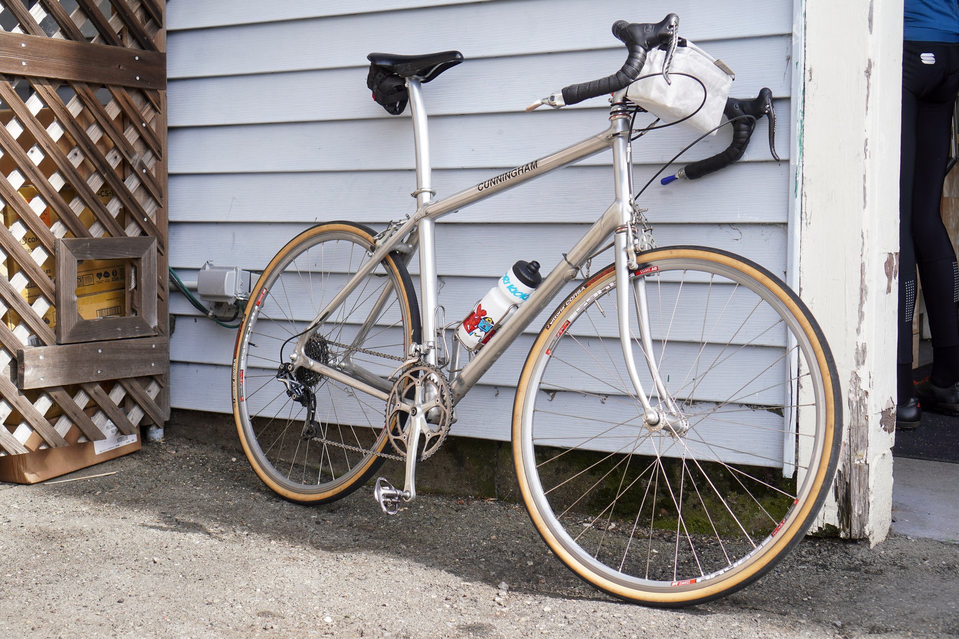
holy shit, a cunningham in the wild!
also: this is an awesome read. you're (almost) selling me on the concept of gravel. neat trip!
also: oddly enough, until recently (in amsterdam, appropriately), i'd never had a stroopwaffel. first bite: this is a honey stinger! then came the quick realization that what i previously thought was a novel product was just an example of clever repackaging / rebranding. but yeah, big bags for cheap.
Reply
Cooper Quinn
3 weeks, 2 days ago
You could have done this trip on a mountain bike with fast tires, but it would have been objectively the wrong tool for the job more often than not.
Reply
Cooper Quinn
3 weeks, 2 days ago
The amount of custom metal rolling around in Marin that I saw on Sunday was wild. Also, that Cunningham has a nice story; apparently it was built for one of his friends who passed away several years ago, and Mike now rides it as a bit of tribute.
I mentioned I was also hoping my custom bike was going to last and be a bit of a Forever Bike, and in truly retrogrouch* fashion, was told, "well, yeah. Its a metal bike."
*also of note, the 9-spd XTR RD.
Reply
liam hoefer
3 weeks, 2 days ago
Oh you mean this Cunningham?
Reply
Dave Smith
3 weeks, 2 days ago
Fun!
I was kinda hoping you would also diary the random thoughts that would drift across your brain.
Ride journal entry 420 - "I wonder why they say elephants never forget? Remember to query Siri later..."
Reply
Cooper Quinn
3 weeks, 2 days ago
Me, buried deep in the hole as dark closed in on Day One, with 350m vert to go:
Reply
MTB_THETOWN
3 weeks, 2 days ago
Very inspiring. You passed within two miles of my house on day 5! In fact, that afternoon i was riding the mtb trails in Joaquin Miller Park you were across the road from.
I sent this article to two riding buddies and the link to day three, which looks like a great route to check out. Especially with a stop at gestalt haus! It looks like the last 10km was just backtracking around though so we will cut that, unless I'm missing something.
Reply
Cooper Quinn
3 weeks, 1 day ago
Hey, very cool! I'd have to check to see if my route plan went through that park or not before I bailed on dirt that day, but I think I was planning to be further up the hill/east.
And yeah on day three, I went to camp, got set up, and then pedaled to delicious camarones tacos and beer, haha.
Reply
Please log in to leave a comment.