What Do You Want for Cypress?
The District of West Vancouver is asking people what they value about the Upper Lands, that large, undeveloped block of land above the highway. All 6,265 acres, all the way out to Horseshoe Bay.
The Upper Lands Working Group is reviewing policies and programs outlined in the 2001 Upper Lands Study and the District’s Official Community Plan. The review will help to determine what lands should be protected, what lands can be developed, uses of public land, and appropriate forms of development.

Pay attention. There may be a quiz.
Last year the Working Group heard from stakeholders and stewardship groups, including the NSMBA and a representative of the Cypress trail builders. Now they want to hear from the general public. This means you!
There are three Open Houses scheduled for public input. At the Community Centre each evening will have two interactive workshops, so come out, grab a clicker and have your vote counted!
Wednesday, February 26
4:30 – 7:30 P.M.
Gleneagles Club House
6190 Marine Drive
Thursday, February 27
4 – 8:30 P.M.
West Vancouver Community Centre
Interactive workshops at 5 and 7p.m.
Tuesday, March 4
4 – 8:30 P.M.
West Vancouver Community Centre
Interactive workshops at 5 and 7p.m.
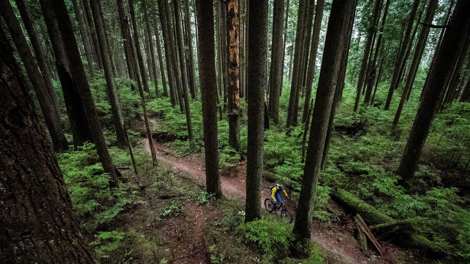
We know that there’s going to be development at the base of Cypress. Many of us are even looking forward to raising a glass or three in the pub at Cypress Village. Located around the first switchback, Cypress Village will have a strong recreational character and British Pacific Properties wants mountain biking to add to the vibe.
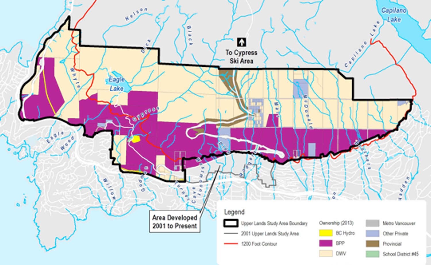
A lot of information will be on display, including maps with land ownership and trails. Pay close attention to where the 1200′ contour is. The OCP limits development above the 1200′ contour, but allows for the possibility of a variation. Consideration of allowing some development above 1200′ would be given only in exchange for securing lands for public use below 1200′ in locations that would otherwise be developed or where there are lands of extraordinary environmental/recreational value. Some of the questions for you to weigh in on include:
– What lands do you consider to have extraordinary value?
– What forms of recreational development above 1200′ would you support?
– Planning is expected to take years. What are the risks of waiting that long for official trails?
– How can identifying areas for recreational trails be expedited?
Watch the Cypress 2014 Conditions thread for more news and info. Links to maps and surveys will be posted as soon as they’re available.
An excellent opportunity to ensure that mountain biking is incorporated into the future of Cypress.


Comments
SneakyBastard
10 years, 1 month ago
The best advocate is an advocate that is informed on both sides of an issue.
This allows for a conversation to take place that is based on as much fact as possible, and not emotion.
IMO the best way forward is to present a united informed group of riders within the NSMBA context to carry on this conversation. AlanB is but one voice but we need to have other supporting voices and energy provided to this cause!
I will do my part as much as I can. In order to be informed… we need to read. Yea, boring… but, out of effort comes results. So everyone that wants to help needs to go through the link from AlanB on the Overview of the Upper Lands.
So here are my notes of important details we need to be aware of:
The PDF of “Guiding West Vancouver's Upper Lands - newsletter”- is about the open houses and general info…
The About The Upper Lands (ATUL) – On Overview IS KEY to our informed participation inside this process:
1. ATUL Map 1 – Key here is that most all mountain biking trails are, or funnel, into BPP land. There is a paragraph here about “Possible 1200 Foot Contour Variation” This is KEY for our interests!
2. ATUL Map 2 – This shows the overall study area circumference and the line going through the middle at a diagonal is the 1200ft line… (which is not red like the legend says it is). This 1200ft line has its genesis in a 1950’s community plan as being the arbitrary line for development based on snow and water/services costing provisioning. Times have changed, the snow line is higher… the DWV could change the 1200ft line or vary it… a trade off for something else… what could that be? Maybe our mountain biking trails… hint hint!
3. ATUL Map 3 – Preamble indicates: “Most municipally owned lands above the 1,200 foot contour line are designated as Conservation and Recreation. Private lands that are not surrounded by municipally owned lands above the 1,200 foot contour are designated as General Urban.”
4. ATUL Map 4 – This is a very important map. Preamble indicates: “Most of the land below 1,200 feet is zoned RS-2, which is single family housing at just over 2 (2.17) units per acre.” Now you see why the historical 1200ft level is important. Review Map 2- see where 1200ft is? See where the mountain biking trails are?” Yea… collision of uses! Map 4 shows this all very well: the green Community Use, the yellow Residential Use. See where are trails are, and where they end up? This is why we are an important piece of this overall conversation. The KEY PART to this map and our interests is the DOTTED LINE indicated in the Legend as the “1200ft Contour Variation”. More on this in my synthesis.
5. ATUL Map 5 and 7 – Sensitive Ecosystem map stuff… review for awareness understanding that this is a consideration obviously in the whole plan.
6. ATUL Map 6 – This is important… this indicates what can be built on what slope gradient. The flatter the slope, the more development (duh)… so steeper crazier trails… mmmm… but… all, if not most, mountain biking trails lead to the flatter slope… leads into the proposed development… a problem we have.
Synthesis: Looking at the maps; understanding the future that development WILL HAPPEN; reading about the 1200ft Variation; and it is obvious that there are trade off conversations that will occur.
To protect our lower trails from development due to the zoning, ownership, and slope gradient… and the reference from DWV that there could be possible “above 1200ft contour development concessions”… to save lower slopes that are of value to the overall community- we need to be a united group advocating for our quality of life of what makes these lands so special, not only for us, but for the wider mountain biking community in general.
Not only that, but we spend money. They are building a little shopping center at the lower hairpin- where we no doubt will spend money on water, bars, coffee, tea… ect. We will help make the community system work. We will only be there in the future if our trails existed taking us to the bottom!!!
Let DWV discuss with BPP the 1200ft Variation… but for DWV to be interested in doing that… WE MUST SHOW DWV that these LOWER LANDS have COMMUNITY VALUE… but also, there is the economic spin off of COMMUNITY VIABILITY of the shopping centers and overall area.
Be a part of our voice. The DWV is giving us this OPPORTUNITY.
Do not waste it. You will regret it.
Reply
AlanB
10 years, 1 month ago
More info available at .
You'll want to look at Map 1: Property Ownership & Trails. The PDF is 2.3 MB.
Reply
SneakyBastard
10 years, 1 month ago
I will be at the March meeting.
Reply
AlanB
10 years, 2 months ago
The maps showing the trails and land ownership will surprise people.
Come and learn what's happening, then tell West Van Planning what you value about Cypress.
Reply
Brett Watkins
10 years, 2 months ago
Please find the time to come out and represent. Someone invite Monica
Reply
Cr4w
10 years, 2 months ago
I look forward to meeting Monica Craver and seeing her there fighting the good fight for the environment!
Reply
Please log in to leave a comment.